
 NWA September 2019 Newsletter
Issue 19 - 9
NWA President Paul Schlatter
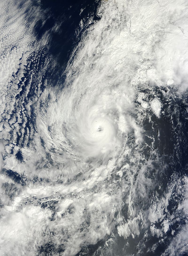
In this month’s newsletter we are talking hurricanes. About the time this newsletter hits your inbox, Hurricane Dorian will probably be threatening the U.S. coastline or perhaps has already made landfall. It’s a testament to Numerical Weather Prediction (NWP) guidance that I can write this message about a week in advance and know it has gotten good enough to forecast hurricane tracks reasonably well even a week out. I’ve always found it fascinating how tropical cyclones in the Atlantic and Eastern North Pacific Basins get their names. The process dates back to before the weather satellite era in the early 1950s. Back then, communicators in the media and the Weather Bureau found that short, easily remembered names for tropical cyclones were an effective way to communicate and identify a storm. They had no idea that more than 50 years later Twitter and other forms of social media would be tailor-made to communicate critical information using short, easy to use names for tropical cyclones. Naming storms became official in 1953 when the United States used female names. In 1979, an update was made to include male names alternating with female names. Name lists are used on a six-year rotation, so if a particular storm that shares your name doesn’t live up to your standards, not to worry, it will be reused six years later. The exceptions are named storms that are extremely deadly or costly. In those cases, reusing the name would be inappropriate (e.g. Hurricanes Michael and Florence in 2018), and the name is forever retired. While probably well-known within our field, but much less so outside of it, the National Hurricane Center (NHC) does not select the list of names. That task is left up to the World Meteorological Organization (WMO) given the fact that tropical cyclones affect many nations. For the Atlantic, Eastern North Pacific, and Central North Pacific Basins, NHC is responsible for naming storms based on the list provided by the WMO. Naming a tropical disturbance begins when NHC forecasters analyze the central pressure at sea level and the estimated winds near the surface. If a storm has a closed circulation and generates estimated or observed sustained winds of 39 mph or greater, it receives a name.
As a weather weenie, I am fortunate to have my name as part of the rotation. I want to be clear, however, that I would never make light of hurricanes and their names, nor would I want to root for a certain named storm to make landfall anywhere. Hurricanes are among the most destructive forces on the planet, capable of ending thousands of lives and destroying billions of dollars of property. With that said, I admit to rooting for my namesake to “look cool” on satellite, which usually means developing into a hurricane with a well-defined eye. Paul is part of the rotation for Eastern North Pacific hurricanes, thus every six years I pay close attention in August and September to see if a Paul storm will form. Paul is 16th on the list (they are always alphabetical) and, on average, 16 named storms occur in the Eastern North Pacific Basin each season. I NEVER want a Hurricane Paul to hit anything of course, or to cause significant flooding. The name Paul entered the rotation in 1982. In all, Tropical Cyclones named Paul became hurricanes three times, tropical storms three times, and in 1988 there were less than 16 named storms in the Eastern North Pacific Basin so Paul never formed. The genesis of Hurricane Paul in 1982 ravaged Central America with catastrophic flooding, but I presume the name was not retired because the flooding occurred before it attained tropical storm strength. It eventually strengthened into a Category 2 hurricane before making landfall along the Baja California coast. Assuming no real destruction, I get a kick out of reading about the demise of storms named Paul. For example, the Tropical Storm in 1994 was summarized with “Paul was completely destroyed by September 30”. I was a senior in high school on September 30, 1994, so I am pretty sure I was not destroyed on that date. In 2000, Tropical Storm Paul weakened and merged with a Pacific trough over Hawaii, dumping over 3 feet of rain on the big island. In 2006 Hurricane Paul attained Category 2 strength off the coast of Mexico before making landfall as a tropical depression. In 2012 Hurricane Paul became the strongest Paul on record, reaching Category 3 strength on October 15, 2012. It skirted the west coast of Baja California as a weak hurricane before weakening shortly thereafter. In 2018 the Paul storm reached tropical storm strength, but I got a kick out of reading the summary statement after it did: “Despite a moderately favorable environment, Paul failed to strengthen significantly and remained a poorly organized system, eventually weakening…” Ouch! I will have to wait until 2024 to see what type of storm (if any) Paul will be in the Eastern North Pacific Basin. You can find all the names in the rotation for the Atlantic, Eastern North Pacific, and Central North Pacific basins on the NHC website. See you in Huntsville! Preparing for Advanced Hurricane Analysis with High-Resolution Satellite Soundings from the NASA TROPICS Mission In 2017, three destructive hurricanes underwent rapid intensification: Harvey, Irma, and Maria. The following year, Hurricane Michael experienced two periods of rapid intensification, the second of which continued through landfall, making it one of only four Category 5 hurricanes to make landfall in the United States. Rapid intensification is defined as an increase in tropical cyclone (e.g., hurricane, typhoon) wind speeds of 35 mph or more in a 24-hour period. These storms are particularly dangerous and pose a significant threat to society. Hurricane Michael’s location in the Western Caribbean and Gulf of Mexico provided the opportunity for multiple aircraft reconnaissance missions: nine flights from the U.S. Air Force, and six flights by NOAA Aircraft Operations Center (AOC). Measurements from these flights combined with data from satellites were used to monitor Michael’s intensification, and to give timely warnings prior to landfall. However, most tropical cyclones are not observed by aircraft, particularly those that occur far from land masses. The current constellation of passive microwave remote-sensing observing platforms is limited by the temporal frequency of overpasses (~ once every 3 hours), which is insufficient to fully observe rapid intensification. Such measurements are crucial for increasing our knowledge of tropical cyclone intensity change, and for providing accurate warnings of storms that threaten both coastal and inland communities. The NASA Short-term Prediction Research and Transition (SPoRT) Center has a history of providing these satellite-observations to the National Hurricane Center to assess storm structure and intensity, and the imagery is regularly used in operations and mentioned in public text products.
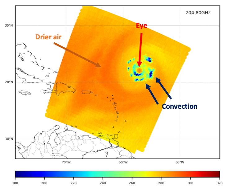
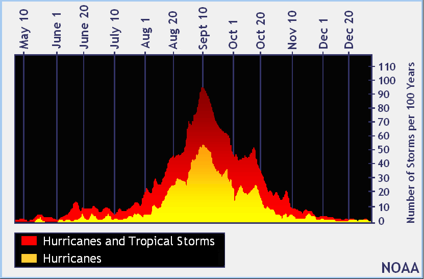
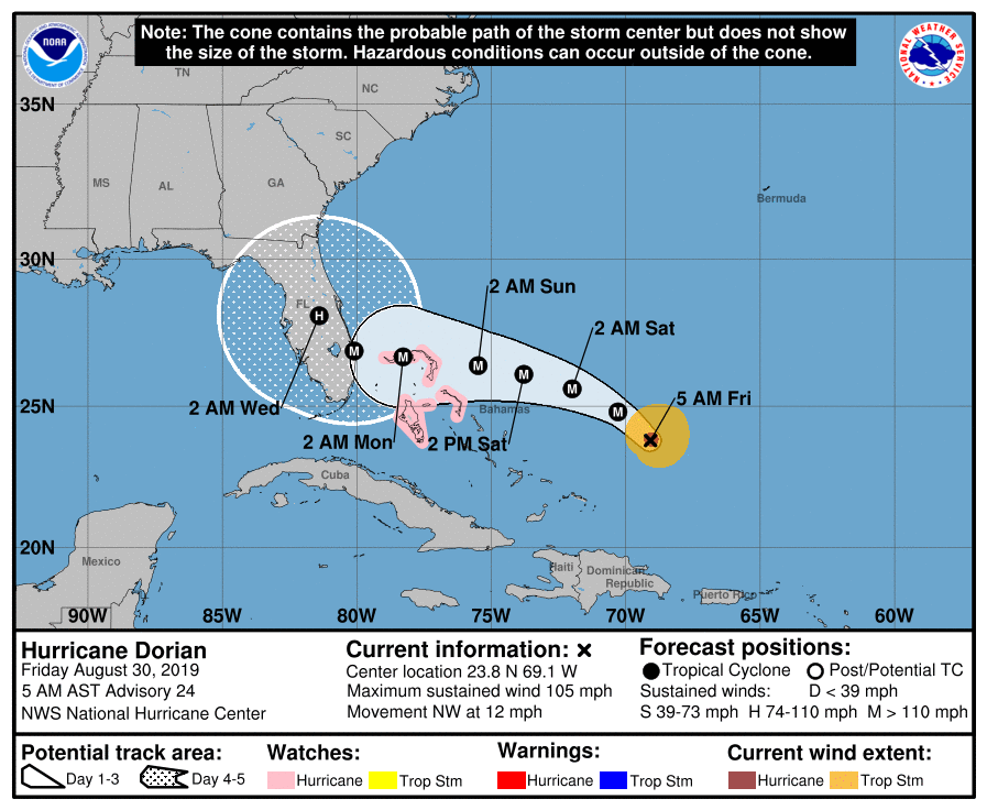
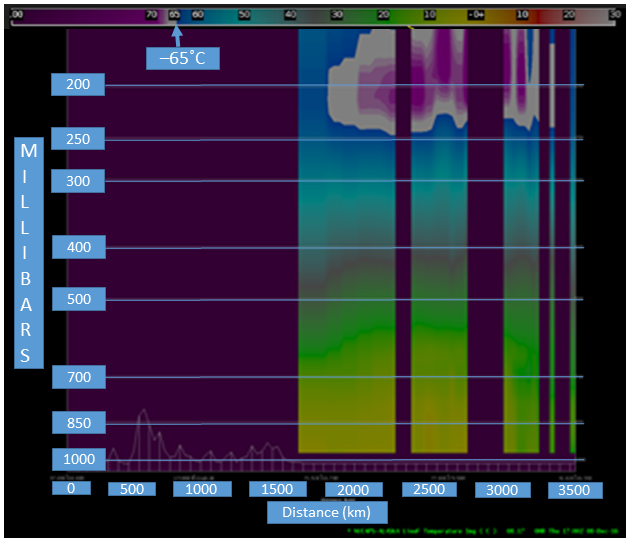
In 2021, we anticipate the launch of the Time-Resolved Observations of Precipitation structure and storm Intensity with a Constellation of Smallsats (TROPICS) satellite designed to measure atmospheric conditions in tropical cyclones. TROPICS will provide weather observations of three-dimensional temperature, humidity, cloud ice, and precipitation horizontal structure over the tropical latitudes with a less than 60-minute revisit time and with unprecedented horizontal and temporal resolution. TROPICS is a constellation of smallsats in low-earth orbit equipped with a 12-channel passive microwave radiometer measuring frequencies from 91 to 205 GHz, which are used mainly for measurement of atmospheric temperature and moisture profiles. These high-temporal frequency measurements will improve the observation of dynamic processes such as rapid intensification, as well as mesoscale time scales that are often challenging to observe. As an Early Adopter, SPoRT is currently assessing the capabilities and applications of the upcoming TROPICS mission by using synthetic TROPICS data. In addition, SPoRT plans to collaborate with operational partners to design new products and explore the utility of TROPICS in the operational environment. TROPICS proxy data are designed to simulate the format and accuracy of the future mission, providing an opportunity to evaluate the potential applications of the mission prior to launch. These proxy data are derived from a high-resolution numerical simulation of a tropical cyclone in the North Atlantic Ocean, capturing a full life cycle. The figure shows an example of TROPICS proxy data estimated at 205 GHz. This channel is sensitive to the distribution of ice in the atmosphere, and can distinguish the ice within deep convective clouds (dark blue colors) and drier air wrapping around the storm (orange to yellow colors). These data, which are available to the scientific community, can help to accelerate our ability to use real TROPICS data once the instrumentation is calibrated in orbit. For more information on the TROPICS mission, applications, and the Early Adopter program, visit www.nsstc.uah.edu/tropics/overview.html. References Berndt, E. B. (2019) Applications: Early Adopters. Retrieved from https://www.nsstc.uah.edu/tropics/early_adopters.html Beven, J.L. et al. (2018) National Hurricane Center Tropical Cyclone Report: Hurricane Michael (AL142018), 7-11 October 2018. Retrieved from https://www.nhc.noaa.gov/data/tcr/AL142018_Michael.pdf Duran, E. L. (2019) Using Synthetic Data to Prepare for the NASA TROPICS Mission. Retrieved from https://nasasport.wordpress.com/2019/08/09/using-synthetic-data-to-prepare-for-the-nasa-tropics-mission/?linkId=71793454 Kaplan, J. and M. DeMaria, 2003: Large-scale characteristics of rapidly intensifying tropical cyclones in the North Atlantic basin. Wea. Forecasting, 18, 1093–1108, doi.org/10.1175/1520-0434(2003)018<1093:LCORIT>2.0.CO;2. MIT Lincoln Laboratory (2015) Time-Resolved Observations of Precipitation structure and storm Intensity with a Constellation of Smallsats (TROPICS): Mission Overview. Retrieved from https://tropics.ll.mit.edu/CMS/tropics/Mission-Overview NOAA (2019) Hurricane Michael upgraded to a Category 5 at the time of U.S. Landfall. Retrieved from https://www.noaa.gov/media-release/hurricane-michael-upgraded-to-category-5-at-time-of-us-landfall Nolan, D. S., R. Atlas, K. T. Bhatia, and L. R. Bucci, 2013: Development and validation of a hurricane nature run using the joint OSSE nature run and the WRF model. J. Adv. Model. Earth Syst., 5(2), 382–405, doi.org/10.1002/jame.20031. Schott et al. (2019) The Saffir-Simpson Hurricane Wind Scale. Retrieved from https://www.nhc.noaa.gov/pdf/sshws.pdf Voiland, A. (2017) A Closer Look at Rapidly Intensifying Hurricanes. Retrieved from https://earthobservatory.nasa.gov/images/91130/a-closer-look-at-rapidly-intensifying-hurricanes Hurricane Season Preparedness Those of us that live along the Gulf and Atlantic coasts are hyper-aware that we are well into the Atlantic hurricane season, which runs from June 1 to November 30. According to the NOAA chart here, the climatological peak of this season is around September 10, just in time for the NWA Annual Meeting! As of this writing, Dorian is on track to become the first major hurricane of the season, forecast to become a Category 4 hurricane with winds of 140 mph as it approaches the east coast of Florida.
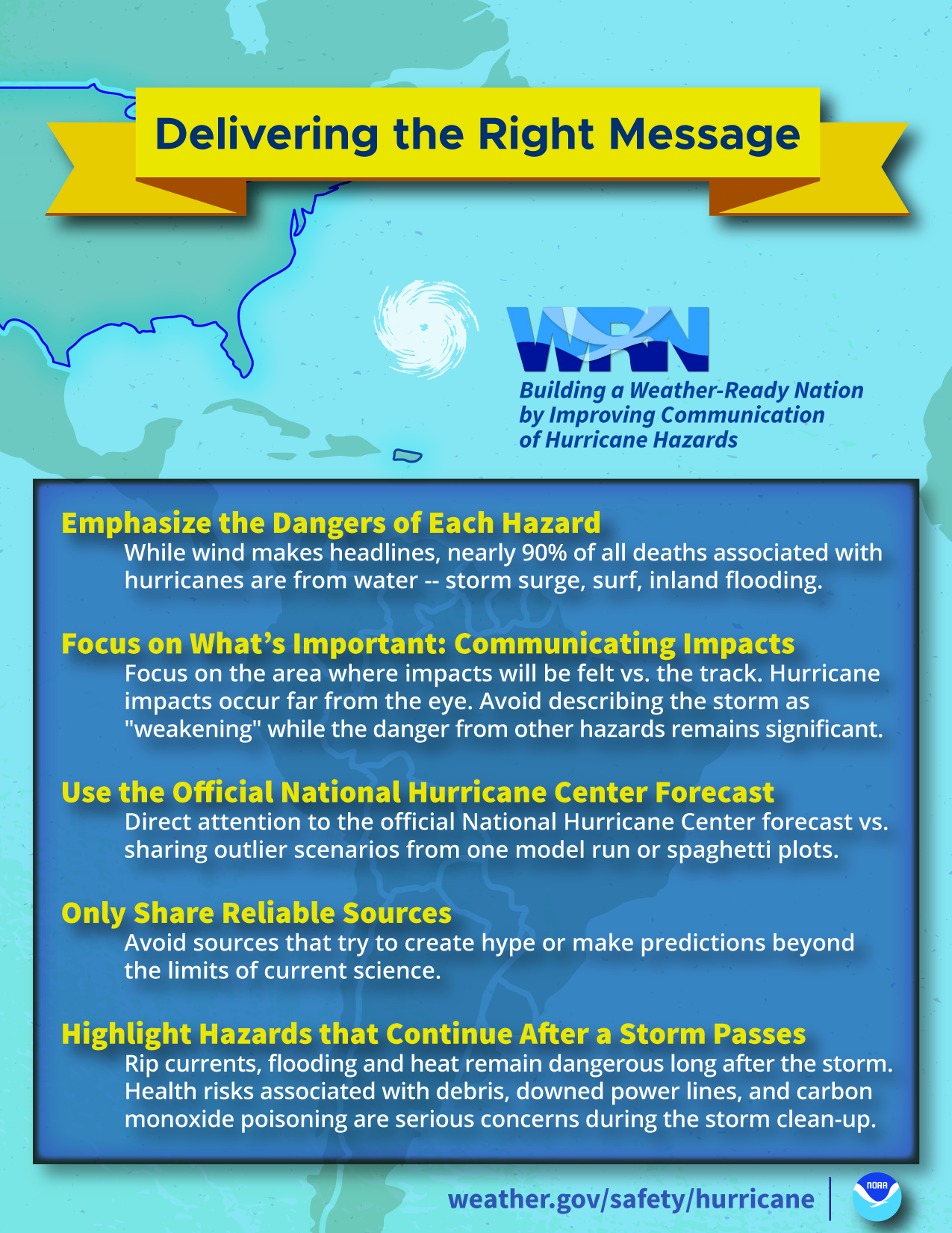
As meteorologists, we understand the danger and the need to prepare ahead of any tropical cyclone. Our friends and family, however, may not be as knowledgeable and could be prone to misinformation spread on social media by unqualified “experts” and those using inaccurate apps. We can counteract the false information by reminding our family, friends and followers to only heed reputable sources: the National Hurricane Center (NHC), NWS offices in the path of the storm, their county Emergency Operations Center (EOC), and their local media outlets. The NHC and WRN Hurricane Preparedness sites have good information to help the public understand the forecast and how to prepare for a hurricane or tropical storm. NHC has all the forecasts graphics you can share and discussions you can draw from to help your followers understand the forecast and how to prepare. It even has a great YouTube video that describes how to properly interpret the cone forecast. WRN has information for hurricane preparedness that is easy to read and understand for the general population. Point your followers to the website or to specific pages on the site. Local EOC centers and television stations also have links on their sites providing helpful information about local resources.
Tropical storms and hurricanes are an inevitability along the Gulf and Atlantic Coasts. It’s a good time for those of us endowed with meteorological knowledge to combat erroneous information and remind our friends and neighbors that the time to prepare is well before the storm’s forecast time of arrival.
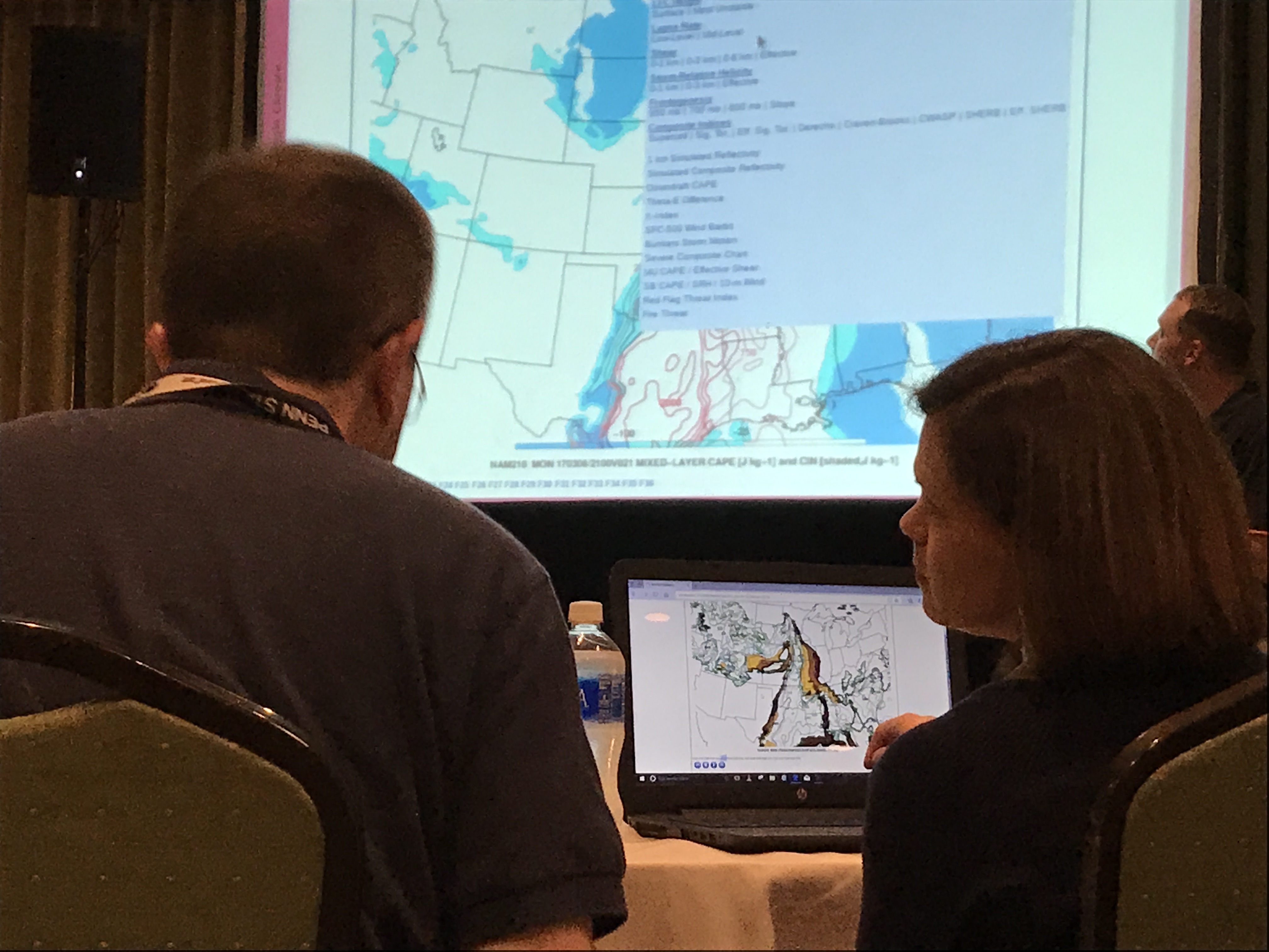
NWA Annual Meeting Master Class: High-Resolution Tools for In-Depth Mesoscale Analysis The Weather Analysis and Forecasting (WAF) Committee will once again sponsor the WAF Master Class at this year's NWA Annual Meeting in Huntsville, Alabama. It will be held on Sunday, September 8, 6:30 to 8:15 p.m. The exact room is TBD…stay tuned! If you are a student or early career professional that is interested in gaining experience forecasting high-impact weather events alongside NWS meteorologists, you don’t want to miss the Master Class! Add it to your Annual Meeting calendar, bring your laptops, and learn how the latest science is being used to enhance decision making and messaging in NWS operations.
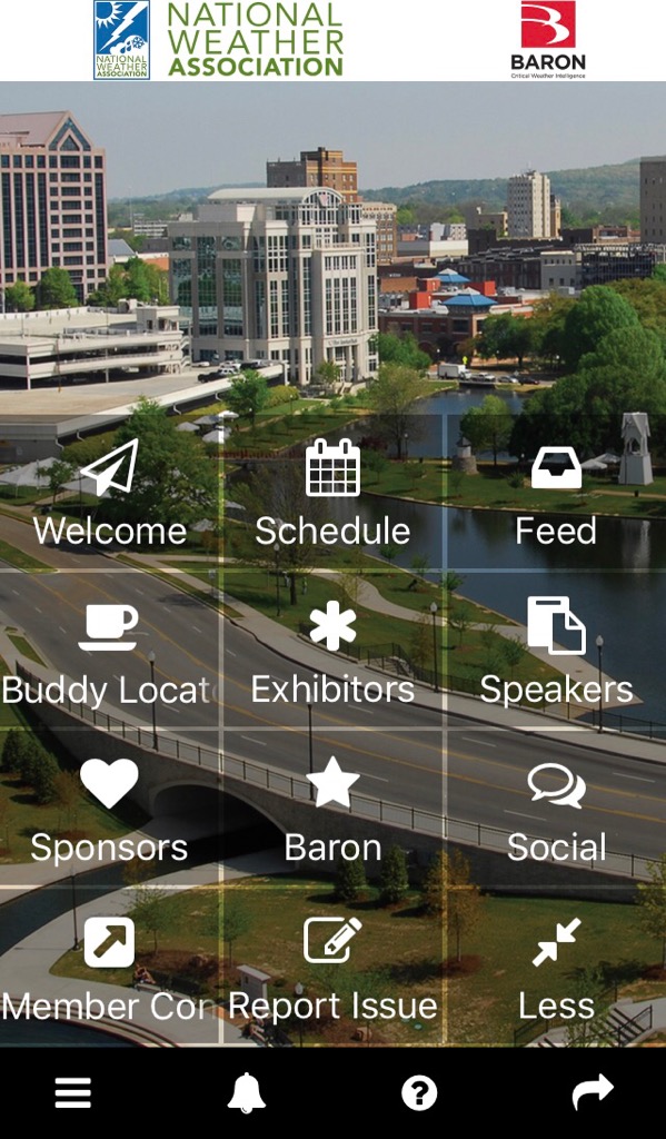
The main objective of the Master Class is to provide participants knowledge and experience in combining conceptual models, observational data, and model forecast guidance to conduct a hazardous weather assessment. In the last two to three years, a renewed emphasis has been placed on the importance of skillful mesoanalysis during NWS severe weather operations. This is due, in part, to the number of high-resolution datasets (e.g., GOES-16 satellite imagery and Multi-Radar/Multi-Sensor System data) available to the operational forecaster in real time. The Master Class will feature subject matter expert (SME) Chauncy Schultz from the NWS Forecast Office in Bismarck, North Dakota, and eight NWS facilitators that will interact with the attendees in small groups. The SME will introduce attendees to high-resolution tools for convective mesoanalysis. Please feel free to reach out to the NWA WAF committee if you have any questions regarding the Master Class by emailing [email protected] or [email protected]. Looking forward to seeing you there! Important Message for Local Chapters If your local chapter elected new officers this year, please make sure that all chapter information is up to date with the NWA. Please fill out the chapter update form and email it to [email protected]. NWA Mobile App for Annual Meeting The National Weather Association mobile app is live and available to all Annual Meeting registrants! Use the app for viewing the Annual Meeting sessions, speakers, exhibitors, sponsors and building your personal itinerary. Log in to the app with the email used for Annual Meeting registration. NOTE: the Annual Meeting agenda will only be updated on the app going forward. Instructions:
For any issues when accessing the app, please send a detailed messaged to [email protected] for assistance. Thank you! Congratulations to our Annual Award Winners Congratulations to the recipients of the National Weather Association (NWA) 2019 Annual Awards, the awards will be presented at the NWA 44th Annual Meeting Awards Luncheon on September 11 in Huntsville, Alabama.
The “Operational Individual Achievement Award” will be presented to Justin Pullin at the National Weather Service – Tallahassee, Florida, for dedicated, selfless, lifesaving service to the Bay County, Florida Emergency Operations Center before, during and after Hurricane Michael. Congratulations, Justin!
The “Operational Group Achievement Award” will be presented to National Weather Service – Tallahassee, Florida for providing life-saving forecasts, warnings and decision support services across Florida and Georgia before, during and after category-5 Hurricane Michael. Congratulations, NWS Tallahassee!
The “Walter J. Bennett Public Service Award” will be presented to Bedarius Bell Jr. for exemplary and dedicated service in helping the NWS promote weather safety and education for the Deaf & Hard of Hearing. Congratulations, Bedarius!
The “Aviation Meteorology Award” will be presented to FedEx Weather Service for exemplary teamwork and service to the aviation community in the Mid-South region. Congratulations, FedEx Weather Service! The “Local Chapter Award” will be presented to East Mississippi NWA Chapter for providing unique opportunities to career growth and improving the connection between chapter members with the local community and national organizations. Congratulations, East Mississippi NWA Chapter!
The “Broadcaster of the Year Award” will be presented to Lelan Statom at WTVF-TV for serving central Tennessee and southern Kentucky with accurate and timely weather forecasts for 26 years with a strong passion for giving back to the community. Congratulations, Lelan!
The “Larry R. Johnson Award” will be presented to Jordan Gerth and Scott Lindstrom at CIMSS/SSEC for outstanding efforts in educating operational meteorologists on the uses and benefits of the new GOES series of satellites. Congratulations, Jordan and Scott!
The “J. Kevin Lavin Award” will be presented to Nezette Rydell at NOAA/NWS for over 30 years of exemplary leadership, mentorship, and public service in the National Weather Service, and for continuously improving the working environment and service delivery. Congratulations, Nezette!
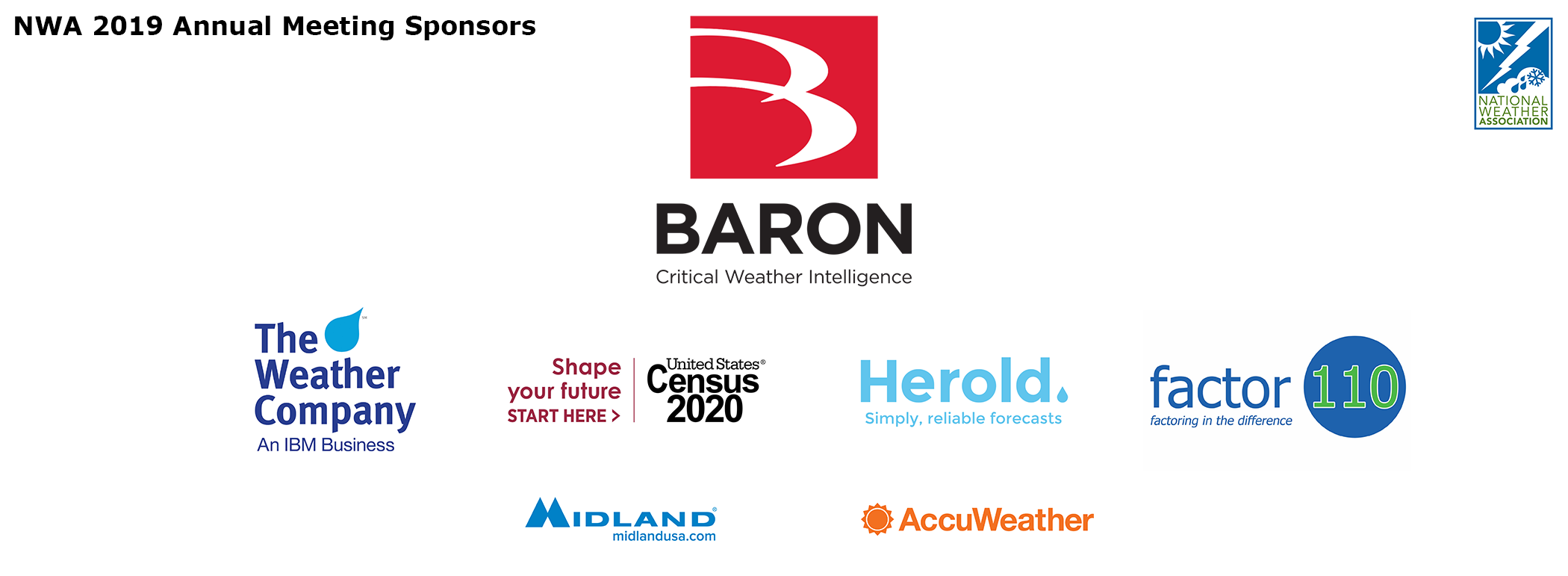
The “Special Appreciation Award” will be presented to Rebecca DePodwin at AccuWeather for her efforts in raising awareness of mental health, work/life balance, and issues for women in meteorology. Congratulations, Rebecca! Thank You to the 2019 NWA 44th Annual Meeting Sponsors
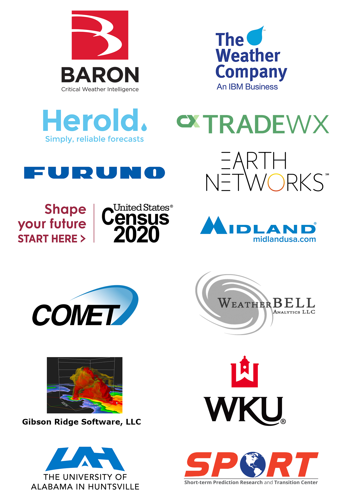
Title Sponsor: Platinum Sponsors: Silver Sponsors:WeatherReady Fest - September 7
The National Weather Association Foundation, a 501(c)(3) non-profit, and National Weather Association members will join with the University of Alabama in Huntsville AMS/NWA Chapter's Rocket City Weather Fest to hold WeatherReady Fest from 10 a.m. – 4 p.m. on Saturday, September 7 in Huntsville, AL. WeatherReady Fest is a public event geared towards education and enjoyment of all-things weather, and everyone is encouraged to attend. “Games, activities, exhibitors, speakers, tours, balloon launches, large equipment, book signings, stage shows, and prizes will all highlight the information that families need to be better prepared when hazardous weather threatens,” WeatherReady Fest Organizer Bill Murray said. Golf Tournament Scramble - September 7 The National Weather Association Foundation Golf Scramble will be held at the Huntsville Country Club. Lunch is included and starts at 12:30 p.m. with tee-off at 1:30 p.m. on Saturday, September 7. The entry fee is $90 with $5 mulligans. Prizes will be awarded for 1st, 2nd and 7th place, along with other awards for “Closest to the Pin,” “Longest Drive” and “Longest Putt.” Proceeds will go to the National Weather Association Foundation, to fund its multiple scholarships and K-12 grant programs.
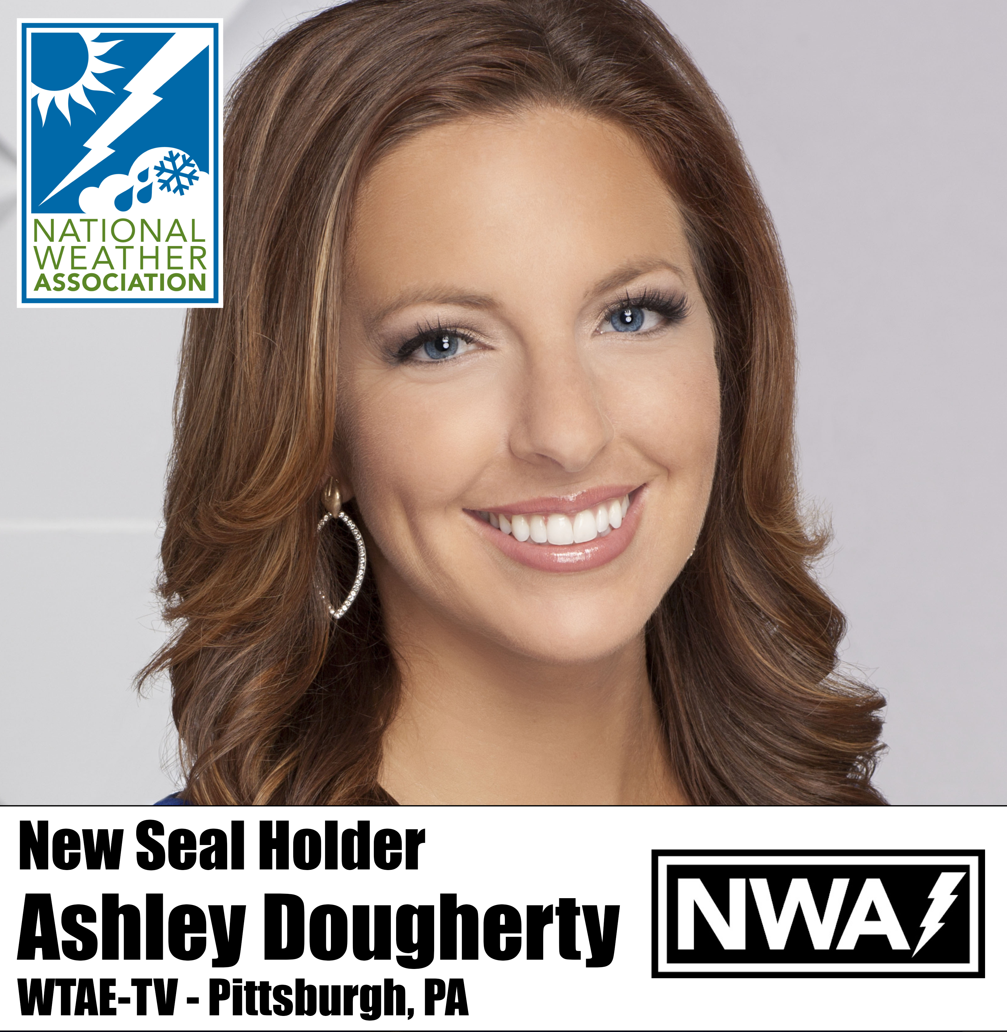
#WhyINWA with Hannah Strong Hannah Strong, meteorologist at WDRB in Louisville, KY, discusses the NWA's impact on early-career professionals, and how presenting at the 2018 Annual Meeting put her face and name in front of hundreds of other weather professionals and peers. Hannah also serves on the Social Media Committee, helping the engagement and growth of the NWA. 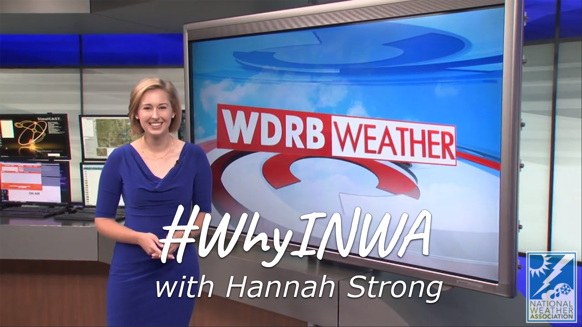 Watch Hannah Strong's #WhyINWA video here. Submit your NWA Member peers, or yourself, on this form to be considered for a future #WhyINWA. And don't forget to chime in on Twitter using '#WhyINWA'! Return to MenuNew Seal Holder It’s time to congratulate our newest TV Seal holder, Ashley Dougherty. A native of Wampum, Pennsylvania, Ashley is back in her home state forecasting each morning and noon for WTAE-TV in Pittsburgh.
Ashley received her B.A. in communications from Bethany College in West Virginia and went on to complete her Certificate of Meteorology at Mississippi State University. Ashley started her career as the weekday morning meteorologist at WTRF in Wheeling, West Virginia, in 2008. By 2012 she was back in Pennsylvania working for WTAE as the weekend meteorologist. She was promoted in 2016 to weekday mornings. She loves that forecasting is different for each day. In her free time, you may find her traveling, playing golf, baking, working out, or spending time with family and friends, or relaxing with her dog Bubba. Ashley is an animal lover. She raises awareness to animal abuse and neglect and works with animal shelters to help dogs and cats find their forever homes. Congratulations again, Ashley, on earning your National Weather Association Television Seal of Approval.
A new NWA JOM article was published in August. JOM 2019-10: Addressing the Cold Air Aloft Aviation Challenge with Satellite Sounding Observations by Gail M. Weaver, Nadia Smith, Emily B. Berndt, Kristopher D. White, John F. Dostalek, and Bradley T. Zavodsky. The JOM publishes submissions in four categories: Article, Short Contribution and Commentary. The JOM is a peer-reviewed, all-electronic journal with an international scope, providing authors with the benefits of economical publication costs and rapid publication following acceptance. If you are interested in submitting a paper to the JOM, please go to the website for author information. Thank you to the JOM authors, reviewers and editors for continuing to make JOM a success! National Weather Association | 3100 Monitor Ave, Suite 123 | Norman OK 73072 | 405.701.5167
Publisher: Janice Bunting, NWA CEO ISSN 0271-1044 |


Announcements

Are you WeatherReady? NWS weather preparedness information.
The NWA is proud to be a Weather-Ready Nation Ambassador™.
*********
For assistance, please contact:
[email protected]
405-701-5167