 NWA November 2018 Newsletter What's in this newsletter... After the Eye of the Storm Hurricane Michael was devastating and deadly—a storm that put operational meteorologists to the test not just in forecasting, but also in communicating threats. Thanks in part to spot-on landfall forecast position and timing from the National Hurricane Center and Hurricane Local Statements from NWS offices, I, as a broadcast meteorologist, was able to relay the most likely scenario to my viewers and social media followers. My broadcast area is centered on Mobile, Alabama, just west of Panama City, Florida, so we were spared. The day before landfall, I was bombarded with this question on social media: “When will it turn?” I’m often asked to explain something that people hear somewhere else. I still haven’t figured out if there were debates on social media about a hard turn like that of Hurricane Irma toward Florida, or if this was related to some off-the-cuff comment made by a broadcaster. I spent too much time and energy with that question, taking away from more critical safety information I wanted to impart. It seemed like there were a lot of armchair meteorologists on social media watching and opining as though it were a sporting event. Without a doubt, there were people in the Florida side of my viewing area, closer to Destin and Pensacola, who were highly concerned that the lack of a turn would have put them in the eyewall. The damage and loss of life from Hurricane Michael was sad but not unexpected for such a powerful storm. My references are Hurricane Katrina and Hurricane Ivan. I got a first-hand look at Hurricane Michael aftermath inland on a journey from Mobile to Tallahassee on Interstate 10. Heading eastward from Crestview, Florida, the damage went from insignificant to many snapped pine trees and tree blowdowns pointing southward east of Defuniak Springs. Marianna showed the signature of trees knocking down power lines with damage in every neighborhood. A dozen miles east of Marianna, I saw trees fallen in a crisscross pattern, indicating east winds from the northern eyewall followed by west winds from the southern eyewall. Another dozen miles to the east and the fallen trees were pointing northward. My west to east travel transect of the fallen tree directions, if plotted on a line, would resemble a meteogram of veering wind. Fascinating for an impromptu damage survey driving at 70 mph. I did stop in a few towns. Common in each were debris piles, slack and broken electric lines, utility crews, blue tarps, the grinding noise of tractors and heavy machinery, the wail of chainsaws, and the smell of pine. A major disruption and cost to families, communities and businesses to say the least. We know the cycle of aid, cleanup, looting, utility restoration, rebuilding, updating building codes, and changes in insurance that typically follow such events, as do questions. Will these smaller communities ever fully recover? How might initial landfall forecasts of a possible Category 1 have played into people’s decision-making? Did climate change energize the hurricane? Why did many models initially miss the eventual strengthening? What could the Weather Enterprise and the public have done better? I want to hear your perspective at next year’s National Weather Association Annual Meeting, September 7–12, in Huntsville, Alabama. If you had responsibility for any of the landscape or entities impacted by Hurricane Michael or Hurricane Florence or any other significant weather event past or to come, your experience and insight will be valuable to attendees. You can also submit a special article for the NWA Newsletter while things are fresh in your mind, volunteer to present your experience at one of our monthly webinars, and submit more in-depth method descriptions and research findings in an article for the Journal of Operational Meteorology. Help the NWA shine a spotlight on colleagues and groups who have made great contributions to operational meteorology in weather events like Hurricane Michael or several events throughout the year(s). Nominate these people for an NWA award so they can be recognized. The NWA bestows more than a dozen awards annually. After Hurricane Michael, national media focused on one fortified home standing alone in a section of Mexico Beach. In damage videos, I noted many other isolated homes standing. The lesson is obvious: build better, build smarter. We can mitigate loss with homes and structures and communities designed for the possible perils in all regions whether they are flood, surge, wind, lightning, tornado, extreme snow, wildfire, landslide, earthquake, tsunami, or even volcanoes. Hurricane Michael is a metaphor for life, business, and associations like NWA: prepare for upheaval, extremes and uncertainties, but follow accepted rules and the advice of professionals while doing so. With the recent approval of the NWA Bylaws, we are building a better and stronger NWA. The decisions we make now play into our resilience as an association later. This month we are voting for the 2019 President-Elect and two directors. Let’s prepare and keep on making each other and society stronger with weather science knowledge. 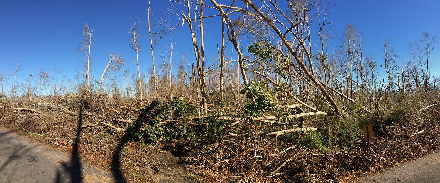 Trees down near Grand Ridge, Florida (photo taken by Alan Sealls)
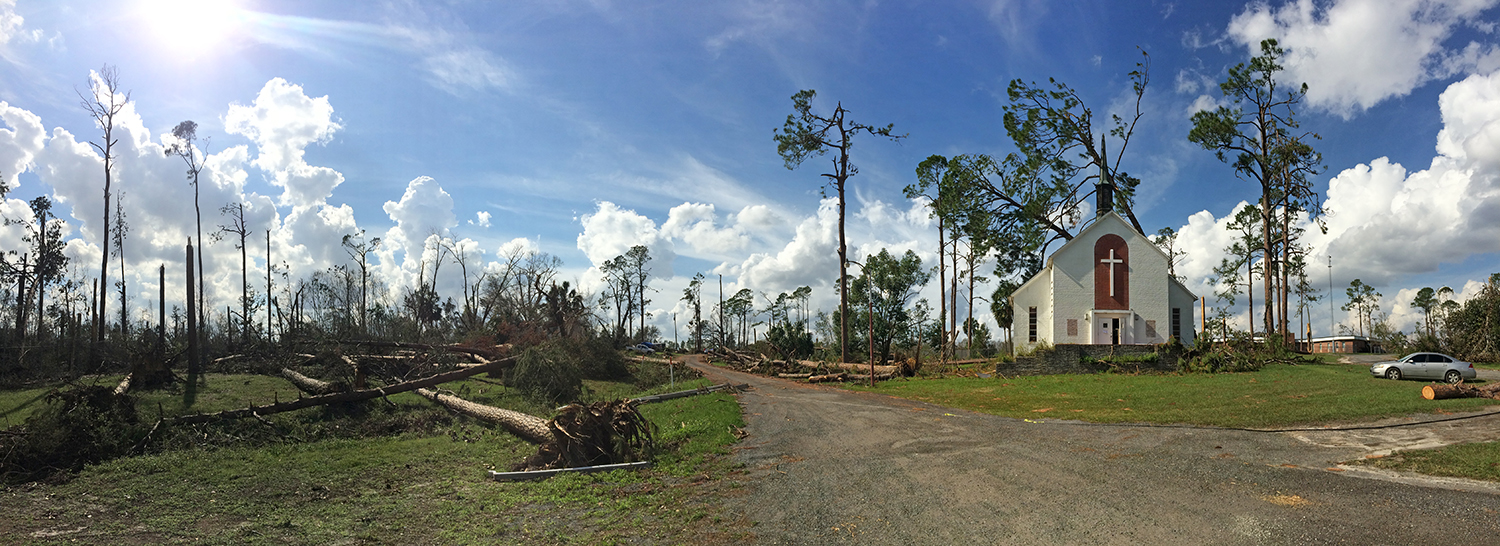 Trees down near a church in Marianna, Florida (photo taken by Alan Sealls)
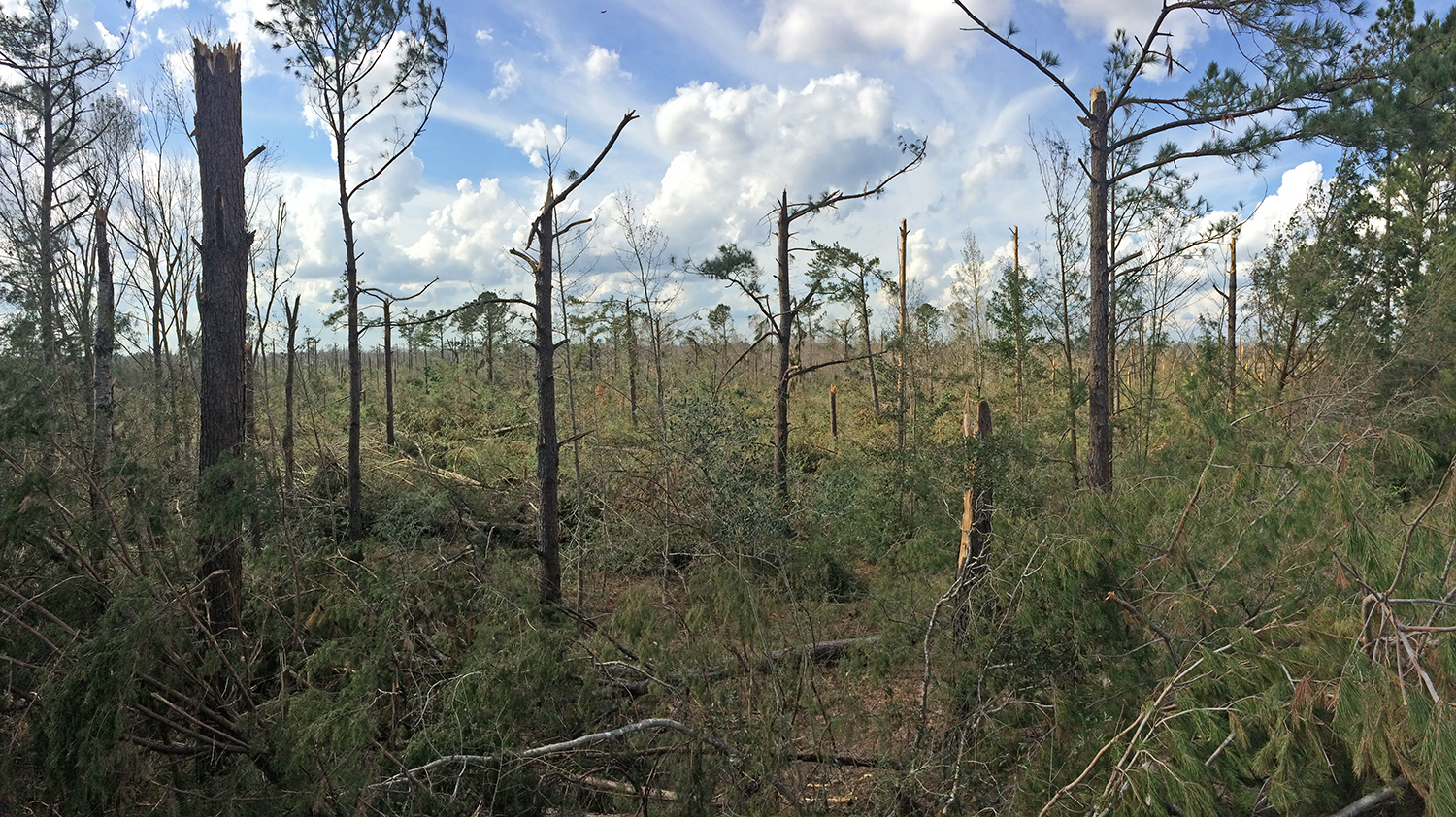 Snapped trees near Marianna, Florida (photo taken by Alan Sealls)
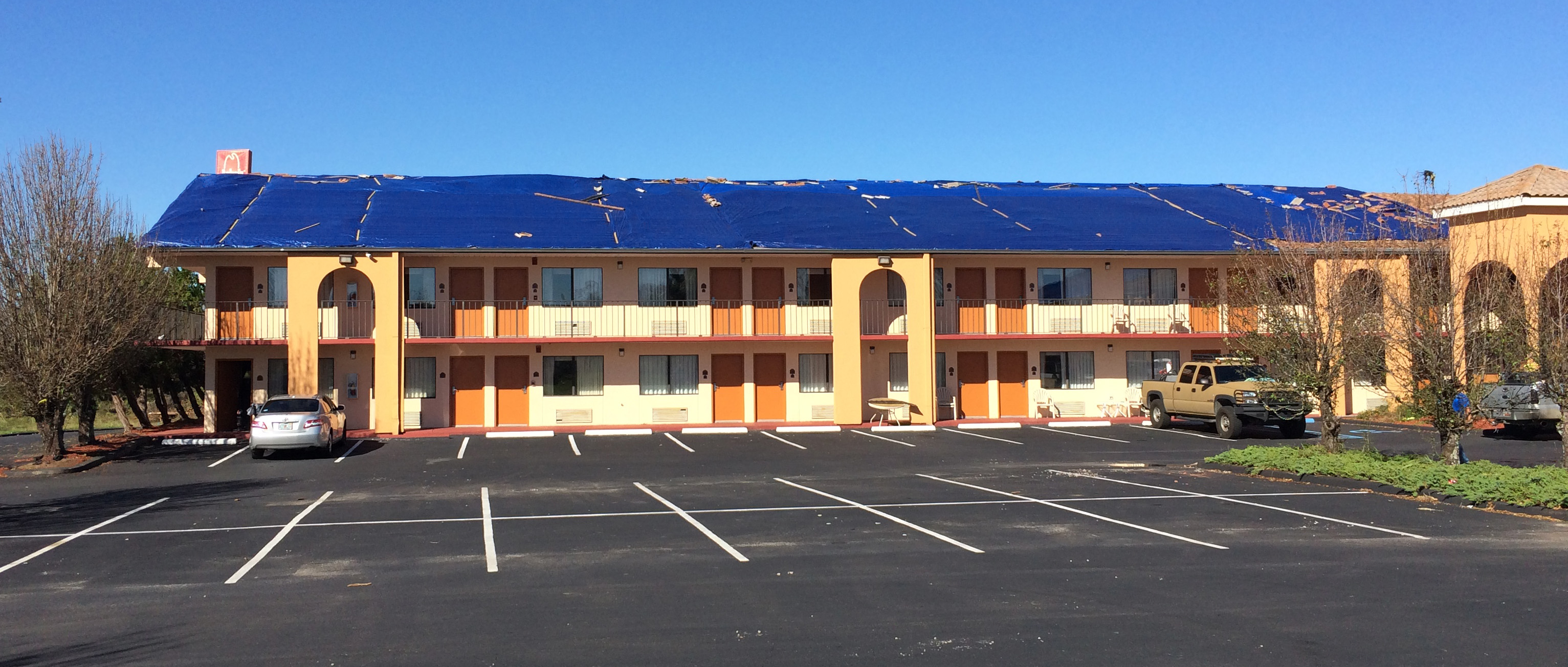 Blue tarps on a building in Marianna, Florida (photo taken by Alan Sealls)
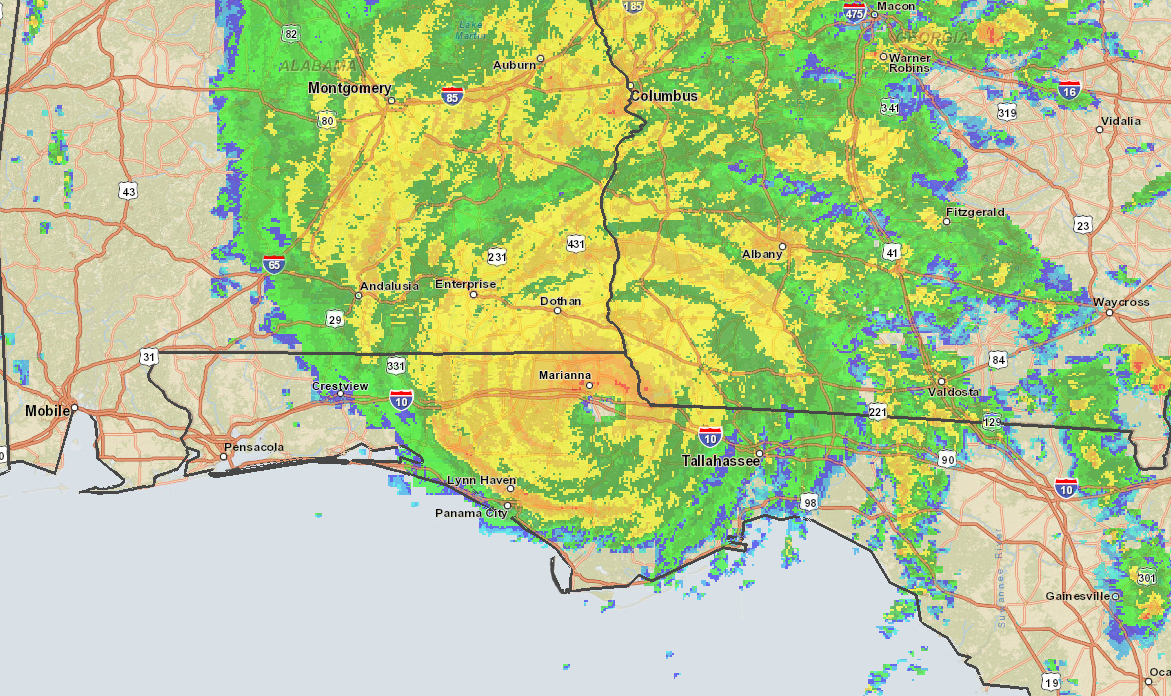 Radar image on October 10, 2018, at 2015 UTC (image from NOAA Centers for Environmental Information, formerly NCDC)
Four Meteorologists Earn Weathercaster Seals of Approval
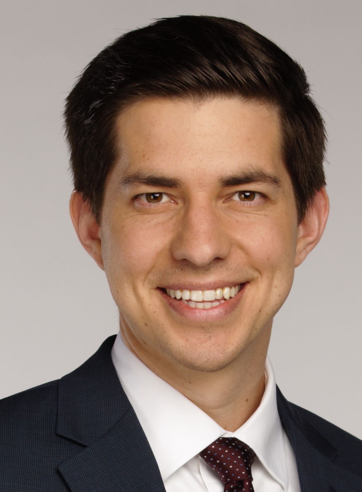
Congratulations are in order for meteorologist Hayden Nix who recently earned the coveted Weathercaster Seal of Approval from the NWA. Nix is currently the weekend meteorologist at KARK Little Rock where he has worked since 2017. “My fascination with weather started at young age from a scary experience with a thunderstorm. The storm uprooted every tree in our yard. For years, I feared dark clouds. That led to an obsession of wanting to learn how the atmosphere worked,” explains Nix. He is a graduate of Mississippi State University and previously worked in Abilene, Texas. A self-proclaimed “tech nerd,” Nix says if he wasn’t doing weather he would be working in IT. His favorite weather to cover is winter weather in Arkansas. “Living and working here, we never get just one type of winter precipitation during an event,” says Nix. “Finding out where and how much is a difficult, yet exciting challenge.”
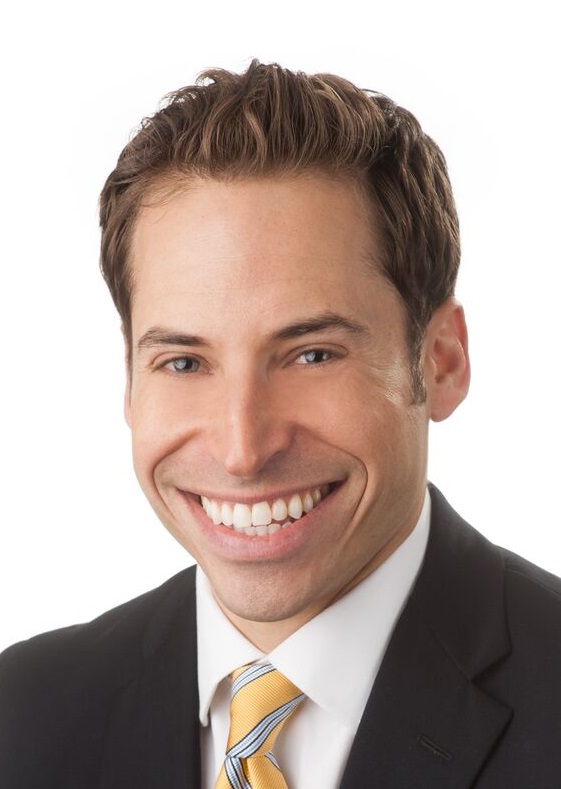
Jordan Sandler of KADN Lafayette, Louisiana, also recently received his shiny new Weathercaster Seal of Approval. Sandler works with the News 15 Storm Team and is back in Louisiana after his weather career got off to a roaring start. On his first day of work as a sports reporter at KPLC Lake Charles, Hurricane Katrina slammed into the state. Four weeks later, Hurricane Rita came blasting into the state and affected his team at KPLC. Jordan was one of the last reporters standing outside before Rita made landfall. “My favorite type of cloud is cumulus congestus, because I love puffy clouds and as a kid I always imagined how fun it would be to jump inside of one,” exclaims Sandler. He says if he wasn’t doing weather, he would love to go back to sports. “If college football season was year-round, I never would have left,” says Sandler. Sandler is a native of Seattle and graduated from the University of Oregon (Go Ducks!)
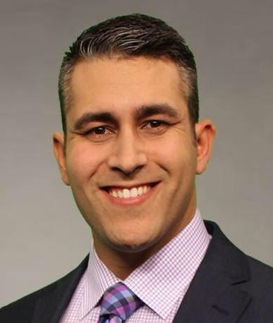
Next up, we have Alberto Romero of KDFW in Dallas earning his Weathercaster Seal of Approval. Romero served in the Air Force, earning more than 80 hours of meteorological credits during his deployments to Afghanistan. He credits his success as a battlefield weatherman from his time in the military. “The training is extensive and fast paced,” says Romero. “It’s like drinking from a fire hose.” Romero discovered his interest in weather at an early age when he witnessed Hurricane Andrew up close. “I walked outside and saw what a Category 5 hurricane did to my city and I wanted to know the science behind it. I wanted to know the why and how it happens,” says Alberto. He says if he wasn’t doing weather, he would travel the world. Just like a lot of us in broadcasting, his guilty pleasure food is pizza.
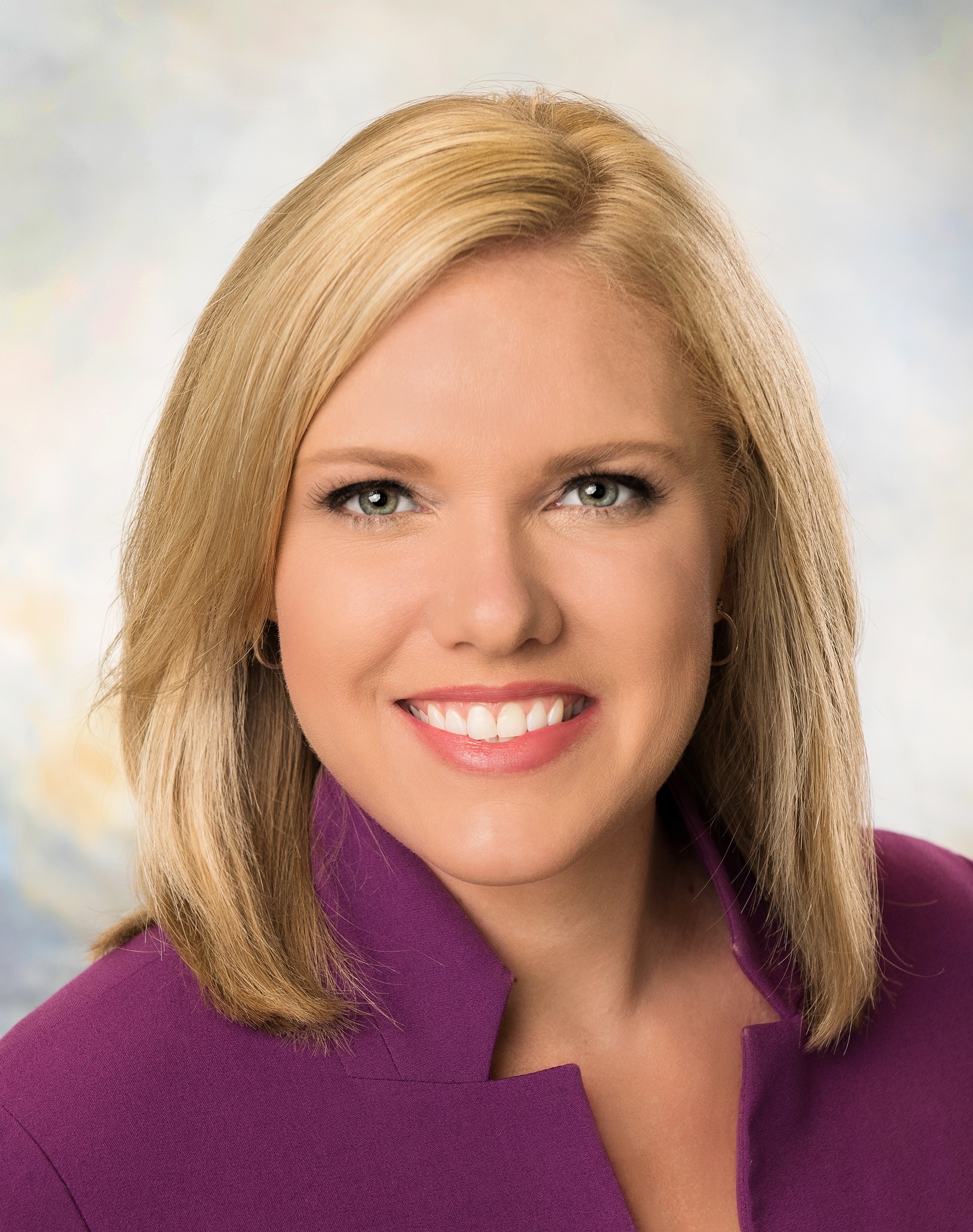
Finally, we have meteorologist Mallory Nicholls from News 13 Orlando, Florida earning her Weathercaster Seal of Approval. She has been part of the weather team for Spectrum News since 2013. Originally from North Carolina, she followed in her father’s footsteps into meteorology. She got her degree in meteorology from North Carolina State University and worked in Tennessee and South Carolina before ending up in Florida. “Tropical meteorology is my favorite type of weather to cover,” explains Nicholls. “I find the evolution and formation of storms fascinating.” Nicholls knows about tropical weather first hand as she witnessed Hurricanes Fran and Floyd in the 1990s when they hit the Carolinas. That’s what prompted her to do research in college on the tropics. “I’m also a big fan of the Food Network,” says Nicholls. She is currently trying to be better at cooking and baking in her spare time along with running and watching football. Take a moment to hit up our new Seal members on social media to say “Congrats!” On Our Radar: Dr. Laura Myers
What was your path into being a social science researcher? I started out as an engineering student because I thought I wanted to study structures, but my true calling was the study of human behavior. I was fascinated by the social sciences and how they explored the reasons for human behavior. My undergraduate degree is in sociology from Clemson University and my master's and doctorate degrees are in criminology from Florida State University. My criminology degrees are multidisciplinary, so I use several social science disciplines in my research, teaching and training efforts. After 9/11, I started applying my social science skills to disaster preparedness, mitigation, and the public’s response to the warning process. I like to do applied research in collaboration with disaster and Weather Enterprise partners to assist them with their operations. This research is designed to validate and help improve emergency planning, disaster response, and the warning communication process. How do you think about what social science is and does? Social science is a framework for understanding how humans behave within a system. Systems are composed of individuals, organizations, and an ever changing environment. The various social science disciplines such as psychology, sociology, communications, political science, geography, and anthropology help us to understand how humans function within any type of system. The system is the context that individuals operate within and it’s enlightening to study that context from multiple levels to determine what makes people do what they do within a particular situation. An example of this would be studying how the various disaster and Weather Enterprise organizations prepare for and respond to an actual event, how the individuals within those organizations affect the functioning of those responses, and how the public reacts and responds to the efforts of these individuals and organizations who have the goal of protecting life and providing safety. At AMS last year, you led a presentation describing how you worked with NWS meteorologists to identify social science research questions relevant to their work and design methods to carry out a pilot study to address those questions. What is the value you see in helping the meteorology community learn about social science? I’ve been working with the NWS for several years participating in service assessments as a social scientist, conducting social science presentations on the warning communication process, and conducting research on actual weather events. The interest of NWS personnel in improving their efforts with their partners and the public is what led me to suggest a series of courses on social science. The goal of these courses was to teach NWS personnel about the elements of social science research so they could collaborate with a social scientist to answer their own operational questions. We’ve been coordinating several projects with the NWS to help guide their research and have seen great results for them and their offices. I’m interviewing you on behalf of the NWA Committee on Societal Impacts of Weather and Climate. What is a societal impact? What do you see as the most important issues we need to focus on as a weather community in terms of societal impacts? Societal impacts are the ways in which weather impacts our emotional and physical vulnerabilities. As humans, we are all vulnerable to weather in a variety of ways, depending on the type of weather impacts and our current situation. The important issue to focus on is understanding that the current context for each individual constantly changes in time and space. No matter how resilient and prepared a person thinks they are for a weather event, it may be more serious than they are prepared for. People may also not be aware that their current vulnerabilities make them more susceptible to weather impacts until it’s too late to prepare. So, to me, societal impacts is all about outreach that can help people realize their vulnerabilities before weather events occur and what they can do to prepare, even if preparation seems impossible given the extent of their vulnerability. I think the Weather Enterprise can learn more about the vulnerabilities in their communities through this outreach and then provide the knowledge people need to respond to weather warnings when they occur. What does the Center for Advanced Public Safety at University of Alabama do? How does it intersect with your research in the Weather Enterprise? The Center for Advanced Public Safety (CAPS) is a software development research center at the University of Alabama. Our focus is on using technology and social science research to improve public safety. I’m the director and serve as the principal investigator on all grants and contracts. We have about 100 research staff and software developers. I also lead the social science research efforts at CAPS, which is where our Weather Enterprise work is done. We manage weather warning improvement grants and we also provide social science research services to operational weather professionals at their request. We provide presentations on social science research and weather, as well as provide responses to questions based on current social science and weather research. What do you enjoy most about doing Weather Enterprise research? I really enjoy how hungry the Weather Enterprise is for social science research to help them do what they do. They care so much about public safety and they want to know what they need to do to reach people and have them take the most appropriate actions to prevent and mitigate weather impacts. This makes my work very worthwhile because I know I’m helping the Weather Enterprise do what they want to do—save lives. It’s been a pleasure working with the Weather Enterprise because they are passionate about public safety and motivated to make a difference with their work. Webinars from Climate Central Climate Central is offering two webinars in November. Attending the webinars will credit attendees with 0.5 CEU for NWA Weathercaster Seal of Approval recertification. Both webinars require registration but are free to attend.
Baron Critical Weather Institute Bob Baron, CEO and founder of Baron Services, Inc., announces the incorporation of the Baron Critical Weather Institute, a not-for-profit organization. The institute is focused on the unique weather and safety challenges of the transportation industry. The goal of the institute is to ensure that citizens across Alabama will receive improved and more timely current conditions and forecasts on roadways and waterways as they travel across the state. This includes creating a comprehensive state-wide weather observation network designed to support improved decision making for citizens and commercial companies in Alabama to enhance safety, increase business efficiencies, and improve the experiences of those traveling or recreating by air, land, or sea. More information can be found on the Baron Critical Weather Institute website. NWA 44th Annual Meeting Location and Dates Announced The meeting will be held at the Von Braun Center in Huntsville, Alabama, September 7-12, 2019. Follow the NWA Annual Meeting website, NWA Newsletter and social media sites for more information. Huntsville is know as "Rocket City." Explore the Huntsville/Madison County Convention & Visitors Bureau website to learn more about Huntsville and the surrounding area. #NWAS19
The 2018 Program Chairs Keith Stellman and Bryan Karrick (on the right) handing over the timer to the 2019 Program Chairs Dan Gallagher and Trisha Palmer (on the left). Ballots for the NWA 2019 Election are Open Through November 28 Elections for the 2019 NWA President-Elect and two new Directors are open from November 2-28. Learn about the candidates. Candidate Biographies. Vote online in Member Connect using this link. If you have difficulty accessing the ballot, The new bylaws are now in effect, and voting periods have changed. Online ballots must be cast by 11:59 pm CST on November 28, 2018. David Russi, Translation Coordinator UCAR/COMET Greetings from Boulder, Colorado! Over the course of the summer, COMET published six new lessons on a wide range of topics including the National Blend of Models, fire weather situational awareness, tropical cyclone wind forecasting, the pressure installment of our instrumentation series, two satellite case studies, and a lesson on the Mei-Yu Front. We also published three new lessons in Spanish—two on communicating forecast uncertainty, and one on basic meteorology. New English Lessons GOES-16 GLM Case Exercise: Buenos Aires Tornado and Hail Event Unified Terrain in the National Blend of Models Situational Awareness in the Fire Environment Determining the Onset and Risk of Tropical Cyclone Winds GOES-16 and S-NPP/JPSS Case Exercise: Hurricane Harvey Surface Flooding Instrumentation and Measurement of Atmospheric Pressure Mei-Yu Front, Part 1: Ingredients for Heavy Precipitation and the Forecast Process in Taiwan
New Spanish Lessons Cómo comunicar la incertidumbre de las predicciones Cómo comunicar la incertidumbre de las predicciones, caso europeo Meteorología básica: procesos atmosféricos fundamentals Currently, these materials are freely available to everyone, courtesy of our primary sponsors: NOAA's NWS, NESDIS and National Ocean Service programs, EUMETSAT, the Naval Meteorology and Oceanography Command, the Meteorological Service of Canada, Bureau of Meteorology, the U.S. Army Corps of Engineers, and the Department of the Interior Bureau of Reclamation.
|
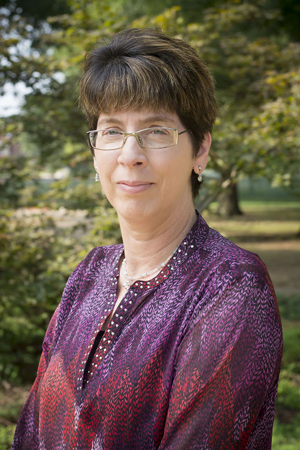 Dr. Laura Myers is the Director of the Center for Advanced Public Safety. She became an NWA member in 2011 because of her emergency management grant work at Mississippi State University and the warning process assessment she conducted for the April 27, 2011, tornado event. She presented the results from that assessment at an event with storm survivors at the NWA 2011 annual meeting in Birmingham, Alabama. The Societal Impacts Committee chose to interview Dr. Myers because of the important social science work she continues to do with the Weather Enterprise and its relevance to our understanding of societal impacts and ways to improve the warning system.
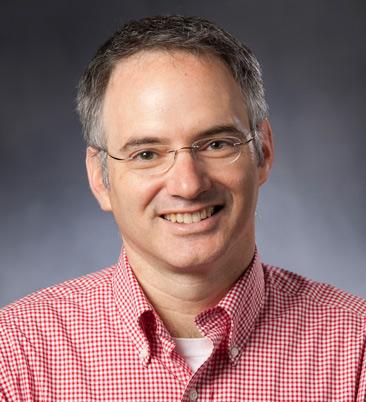 The Economics of Climate Change
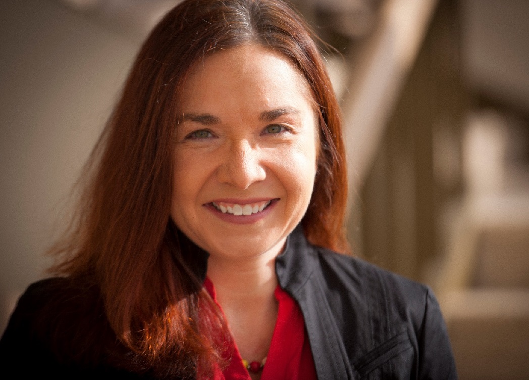 State of the Science: Previewing the 2018 National Climate Assessment
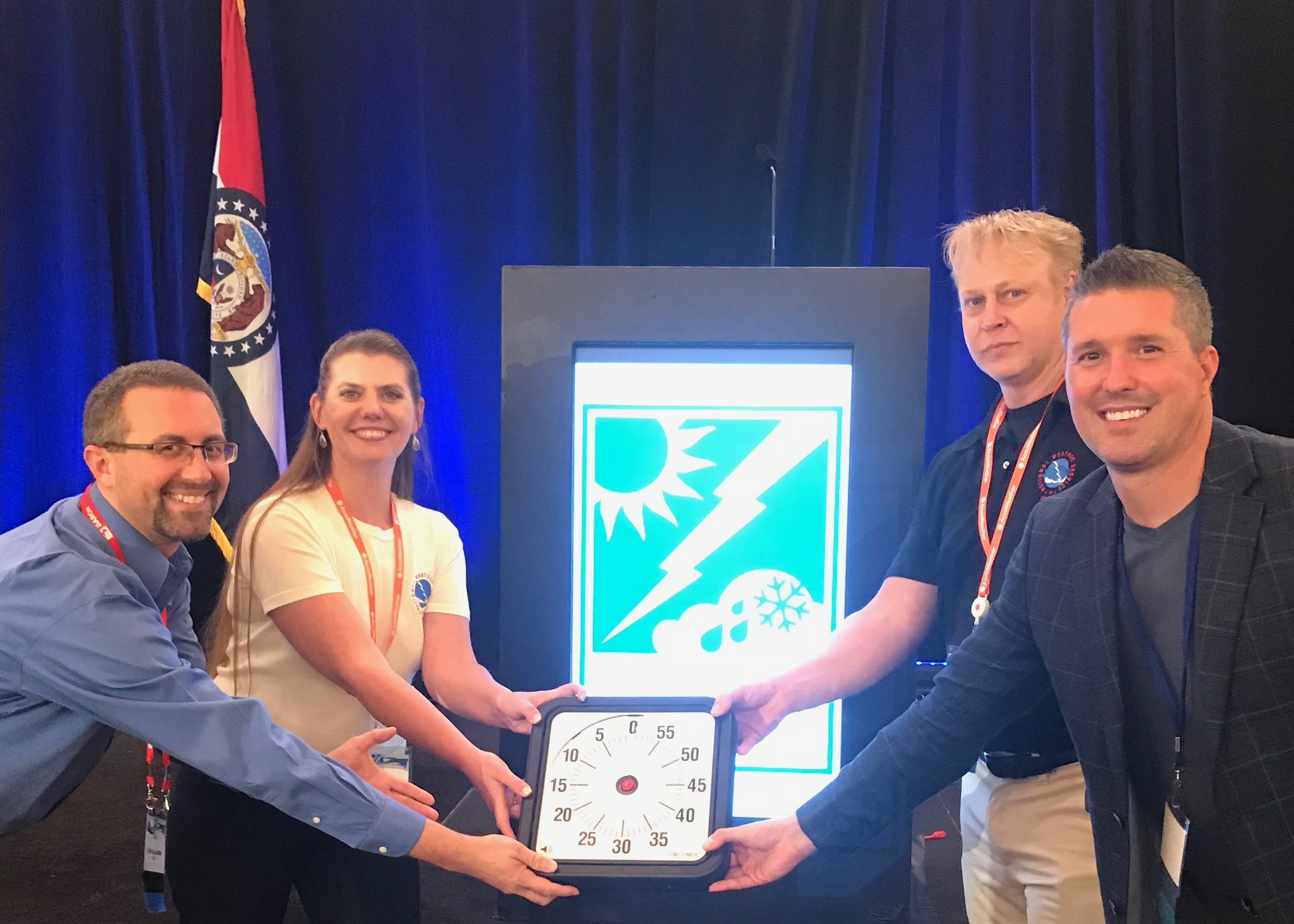
Announcements
Are you WeatherReady? NWS weather preparedness information.
The NWA is proud to be a Weather-Ready Nation Ambassador™.
*********
For assistance, please contact:
[email protected]
405-701-5167