 NWA May 2019 Newsletter
Issue 19 - 5 NWA President Paul Schlatter
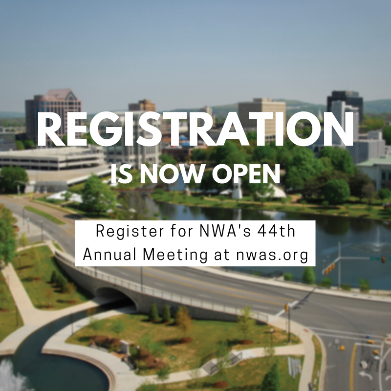
I can hear you thinking, “Paul, where are you going with the title for this month’s message? That’s odd even by your standards!” I will explain shortly, and I promise it will make sense. I can’t dig into the meaning of the title without first recognizing the hard work of the 2019 NWA Annual Meeting program chairs: Trisha Palmer and Dan Gallagher. They are leading a team of hardworking NWA members that recently combed through every single submitted abstract. In case you were wondering how that all works, abstracts are scored by multiple reviewers, most of whom have specific expertise in the field of interest. Then the co-chairs and others pow wow on how to fit the highest scoring oral presentations into a schedule, ensure they are grouped together appropriately, and flow from one concurrent session to the next. The process is akin to planning a wedding with overbearing in-laws (FWIW, my in-laws are fantastic). There are so many moving parts and unforeseen constraints. The team is powering through the process and doing a fantastic job with everything, and we should all be proud of the job they are doing as they assemble a draft agenda. I am confident that the fruits of their labor will show in grand fashion in Huntsville, in the best possible way for all of us who attend. You’ll get your first look at a draft agenda this month, be on the lookout for the announcement. Back to the interesting (odd?) title of this month’s message. Have you ever seen a commercial for an event like a monster truck rally or drag racing? The announcer on the commercial usually has an extremely animated, deep, raspy voice, and says something like “Come on down the county fairgrounds for more horsepower and mud that you can possibly handle! You’ll pay for your entire seat, but you’ll only need half of it since you’ll be on the edge. The action is on SUNDAY SUNDAY SUNDAY!” Those commercials are appropriate for Sunday at the NWA annual Meeting in Huntsville, Alabama, on Sept. 8, 2019! I get fired up just thinking about the line-up and activities being planned for Sunday (though don’t expect the horsepower and mud part). No longer is Sunday aimed at broadcasters and students. Sure, the themes will be slanted towards broadcasters and students, but this year the annual meeting planners and I asked ourselves, “why have we always done it this way?” Was there a specific reason why these groups were separated from the rest of the annual meeting, and the rest of the attendees? I have attended broadcast and student conferences on Sunday in previous meetings, and they are fantastic. I personally got a lot out of them, and as a result I’ve become confident that everyone in our great association would also benefit from hearing those talks. In previous years, some of the talks on Sunday were repeated later in the week, which to me meant other oral presentations were denied in lieu of a repeat presentation. I also believe students and broadcasters will benefit from others outside that sector joining the fun, providing different perspectives as appropriate and the means to build connections and networks. All these considerations led us to believe that Sunday should be an integrated time where attendees from all sectors could show up and experience some amazing sessions. I urge you all to make plans to attend all of Sunday no matter what sector you represent. Another reason to come earlier is to participate in an Integrated Warning Team (IWT) we have planned for Sunday afternoon, which can offer those of us who are passionate about the NWA and Annual Meetings a change of pace from “death by PowerPoint” presentations. While some of you have been involved with IWTs, or perhaps even hosted one recently. I suspect many of you have never been involved and perhaps don’t know what they are. In a nutshell, they are a great way to “Pay it Forward” by talking a walk in someone else’s shoes—someone from a different part of the weather enterprise. That is the essence of the IWT being planned on Sunday. We are planning on having one large room acting like broadcast meteorologists, complete with the ability to broadcast live, and a second large room acting like NWS meteorologists, complete with the ability to issue warnings and receive spotter reports (and other realistic bits of information) from multiple sources. The rooms will be communicating with each other through multiple means. The catch is that if you are a broadcaster by trade, you’ll be in the NWS room helping make warning decisions. The NWS folks will be in the broadcast room, cutting in on “Dancing with the Stars” to deliver life-saving, actionable information to the public. If you are not affiliated with either sector, you can choose which room to participate in. I have been a part of many of these types of scenarios, and they are always eye opening for participants who walk away with a deep appreciation of how other sectors operate during severe weather events. Even if the prospect of attending some awesome talks, participating in an IWT, and networking with students and broadcasters is not enough to entice you to attend the Annual Meeting, perhaps this will. Okay, it’s not on Sunday, but we are partnering with VORTEX Southeast (SE) conference organizers. They (VORTEX SE) were planning on coming to Huntsville anyway for a day or two, so we invited them to join us at the end of the week in the same meeting space. This way more people affiliated with NWA can attend the VORTEX SE conference, and more people from the VORTEX SE conference who are not NWA members will be exposed to how awesome our Annual Meeting is. This integration is occurring on Thursday, September 13. We’ll have a VORTEX SE session during NWA annual meeting, then the official VORTEX SE conference will begin Thursday after lunch. This is a change from previous years where we would wrap up the NWA annual meeting at the end of the day. Thus, we are ending a half day early but starting a full day early on Sunday. All the more reason to make it to all of Sundays activities. The registration link will be opening soon, be on the lookout. The Other Flashes in the Sky: GLM’s Ability to Observe Meteors Did you see that bright flash in the sky on Friday, February 1? No, not that flash of lightning. Did you see the meteor explode over Cuba? If you missed it, don’t worry. The GOES Geostationary Lightning Mapper (GLM) saw it. When it launched in November 2016, NOAA and the rest of the weather world had great expectations for the GLM, NOAA’s new operational lightning mapping instrument in geostationary orbit. After all, the lightning research community has seen the value of lightning imagers in low earth orbit, like the Optical Transient Detector and TRMM-Lightning Imaging Sensor to diagnose convection on a global scale. GLM improves upon those efforts with a hemispheric field of view, near-continuous sampling, and several sophisticated algorithms and filters that map lightning in space and time, providing a two-dimensional view of lightning as it propagates through a cloud. But, unexpectedly, GLM can detect bright meteors, called bolides, as they burn up, break up, or explode in Earth’s atmosphere.
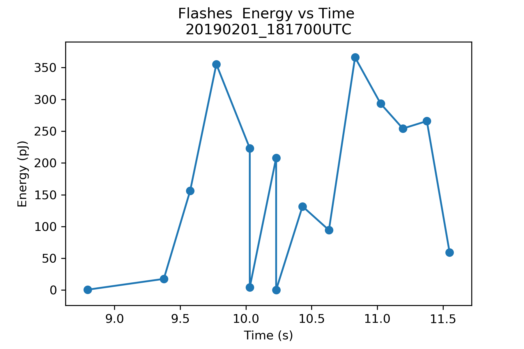
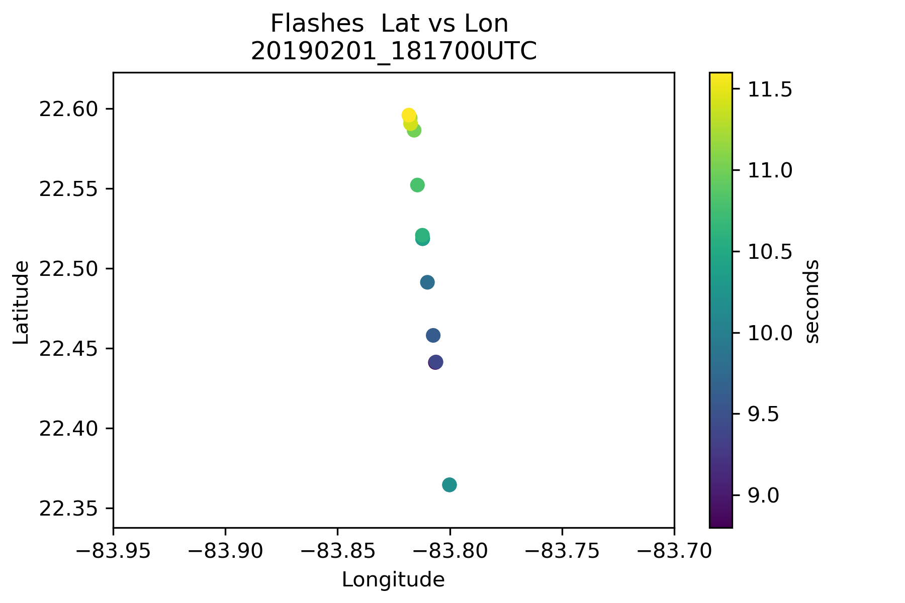
GLM detects light from meteors partly because meteors look more like lightning than noise. Long, bright flares of light produced as bolides break up in the atmosphere can resemble continuous current lightning flashes in which a charged channel lights up for tens to hundreds of milliseconds. In other cases, the meteors appear to be incredibly weak, unenergetic lightning flashes, nearing the bottom threshold of detection for the instrument. Many of these weaker events are filtered out in the operational datasets and must be reconstituted from the raw data. The Cuba bolide from February 1 is certainly an example of the larger meteor events detected by GLM. It was a bright blast of energy, packing about 1.4 kilotons of impact energy according to U.S. government sensors that track and measure meteors. Some small meteorites survived all the way to Earth’s surface. GLM saw a highly energetic light source flash energy peaked at over 350 picojoules (pJ; 10-12 J) and the detection lasted about three milliseconds (Figure 1). The flashes from the nearby storms in the Gulf of Mexico that GLM also detected peaked at about 30 pJ. Most importantly, it was observed in the daylight given GLM’s unique ability to detect light emissions during the day as well as at night. Initially, witnesses reported seeing the bright flash tracking northeast to southwest according to the American Meteor Society. But the actual trajectory calculated by the U.S. government sensor network appears to be closer to due north, and GLM observations confirm that trajectory (Figure 2). Eye witness reports can be unreliable for a number of reasons, but in the absence of global networks of meteor cameras, witnesses (and their ubiquitous pocket technology) tend to be the best sources of information about meteor activity. Now, GLM could be added to the mix of data sources for meteor scientists, meteorite enthusiasts, and government agencies seeking to characterize these events, and it can potentially do it in real-time. Additionally, GLM is providing value in cases where the meteor activity is quite a bit less noteworthy. Smaller bolides from last August’s Perseid meteor shower disintegrate at altitudes exceeding 70 km. These meteors have brightnesses, or magnitudes, rivalling that of the planet Venus, but have also been detected by GLM. The energy that makes it to GLM from those bolides tends to be minimal, on the order of 15 to 45 femtojoules (fJ; 10-15 J), which is very near the dimmest activity that GLM will detect, comprising a handful of events that are condensed into single flashes. Soon, GLM might be used to help characterize those meteor events, too.
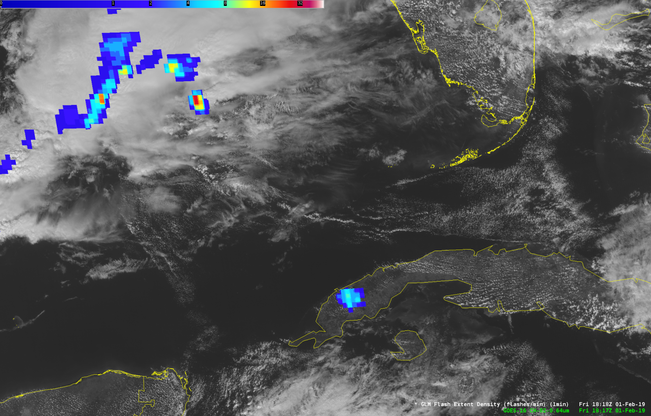
NWS forecaster Kris White (WFO Huntsville) has helped us understand what impact this new detection talent might have on operational forecasters by saving imagery from the Cuba bolide using GLM flash extent density (FED) in AWIPS, the data framework used by NWS forecasters (Figure 3). The animated AWIPS imagery shows some specific points about detecting bolides in AWIPS, or any other visual display of GLM. First, it happens fast. FED is displayed as 1-minute snapshots, and the three second bolide is, of course, only seen in a single frame. The bolide is also isolated, and FED shows a very focused series of “flashes” in one spot, instead of the branching cluster of flashes that electrified clouds often produce. Even when bright meteors break up in the atmosphere, most of them do not scatter far and wide or persist, making them look suspiciously unlike lightning in any product used by forecasters. In some instances, such as the western Cuba bolide, the meteorological environment may also not support the existence of lightning, with no convective type clouds present. So, when your phone banks light up like an exploding meteor because everyone saw or posted about the latest bright light in the sky, there is a good chance that GLM saw it, too. The High Plains AMS/NWA Chapter Minutes The AMS/NWA High Plains Chapter held an in-person meeting at the Norton Library on Monday, April 15, at 11:30 a.m. with 15 chapter members. The first topic discussed was the election of chapter officers. An email was sent to the members a few weeks prior to the meeting to determine if anyone was interested in becoming an officer. Members should contact Jeremy Martin to nominate someone or oneself. The next topic was about the redesign of the High Plains website. Elizabeth Vickery has taken over the duties of Webmaster and has modernized the design. The current High Plains Chapter logo isn’t working properly on the new webpage, so ideas for a new logo will be coming soon. In addition, an email will be sent out when the new website is ready to go live. A general overview of the High Plains Conference was discussed next. As of now, keynote speakers for the conference are Dr. Steve Smith (Director of NOAA VLAB), Dr James Marquis (Center for Severe Weather Research), and Scott Mentzer (retired Meteorologist in Charge of the Goodland, Kansas, NWS office). Scott Mentzer will be the main speaker at the banquet. There is also a chance that Chris Strager (Director of Central Region NWS) and Dr. Louis Uccellini (Director of the NWS) will be able to attend the conference. A member suggested to give an award for leadership each year at the conference, and to name it the Mentzer Award of Leadership. If implemented, the first award will be given to Scott Mentzer since he was a founding member of the High Plains Chapter. More details and a vote will be sent out shortly to see if members are interested in presenting this award every year. John Gordon (Meteorologist in Charge of the Louisville, Kentucky, NWS office) gave two presentations at the meeting. The first was about how he was able to change the intensity and damage points on a tornado that went through portions of Kentucky on May 18, 1995. Previously the damage caused by this storm was reported as straight line wind damage. His second presentation was on weather history. After the presentations, the meeting concluded around 12:30 p.m. The next High Plains Chapter meeting is expected to be in a couple of months. COMET Quarterly Announcement Spring 2019 by David Russi, UCAR/COMET Translation Coordinator Greetings from Boulder, Colorado! COMET was productive during the chilly winter, but we are looking forward to warmer spring temperatures. Below you will find links to COMET’s newest publications on MetEd. Over the past three months we published 12 new lessons on a range of topics: NWP, ensemble prediction system (EPS) guidance, social science training, structure recognition, Land-SAF products, and scenario-based planning for sea level change. We also published 4 new lessons in Spanish, and a new French lesson on interpreting and communicating EPS guidance. New Lessons New Television Seal Holder: James Hopkins 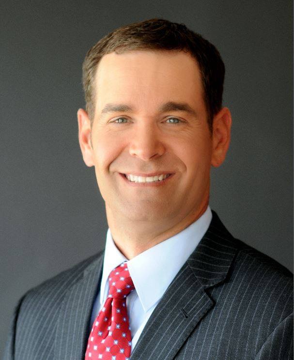
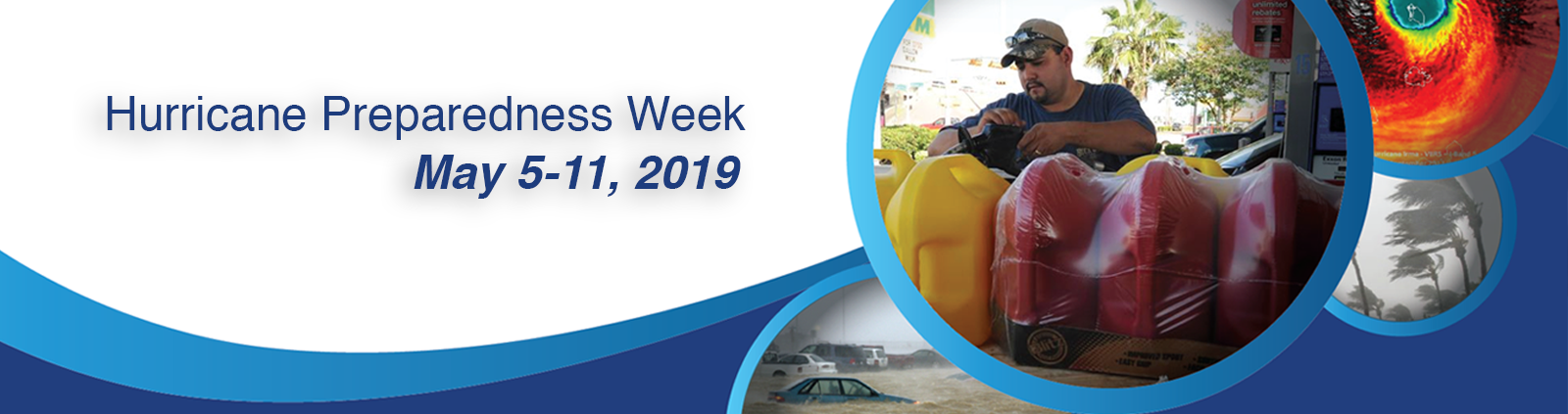
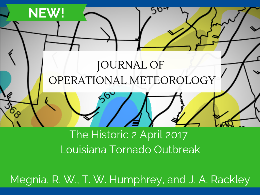
James Hopkins, the morning meteorologist at WBTW in Myrtle Beach, South Carolina, said he and his family consider the Myrtle Beach area home even though he’s a native of Charlotte, North Carolina. Hopkins earned his bachelor’s degree from Mississippi State University in 2007 and landed his first job at KKCO in Grand Junction, Colorado, before taking positions in Savannah, Georgia, and Charleston, West Virginia. Hopkins said his true passion in meteorology is forecasting and tracking hurricanes. "Tropical weather is the main reason I got into meteorology,” he said. He has tracked Hurricane Matthew and Hurricane Florence, both which heavily impacted his area, and said he may one day pursue an advanced degree in tropical meteorology. "Understanding hurricanes and tropical storms has always intrigued me,” Hopkins said. Congratulations to James on earning his NWA Television Seal of Approval! May 5 to 11 is Hurricane Preparedness Week As we all know, impacts from tropical systems often extend well inland and away from immediate coastlines, sometimes for days on end. As warmer weather becomes more prevalent across the U.S., we should refresh ourselves with the hazards and impacts of tropical systems. May 5 to 11 is Hurricane Preparedness Week, sponsored by the National Weather Service. Every day will feature a theme, ranging from determining your risk to strengthening the resilience of your home. The NWS offers pre-made social media graphics and corresponding text that you can post on your personal and professional social media accounts, as well as tips to convey complex forecast and impact information effectively and without jargon. The Hurricane Hunters will also visit a number of locations prone to impacts from tropical systems in the U.S. and Caribbean Basin. Now is the time to prepare! New Publication in the Journal of Operational Meteorology JOM 2019-2 (Article): The Historic 2 April 2017 Louisiana Tornado Outbreak by Megnia, R. W., T. W. Humphrey, and J. A. Rackley. The JOM publishes submissions in four categories: Article, Short Contribution, Images of Note and Commentary. The JOM is a peer-reviewed, all-electronic journal with an international scope, providing authors with the benefits of economical publication costs and rapid publication following acceptance. If you are interested in submitting a paper to the JOM, please go to the website for author information. Thank you to the JOM authors, reviewers and editors for continuing to make JOM a success!
National Weather Association | 3100 Monitor Ave, Suite 123 | Norman OK 73072 | 405.701.5167
Publisher: Janice Bunting, NWA Executive Director
ISSN 0271-1044
|
Announcements
Are you WeatherReady? NWS weather preparedness information.
The NWA is proud to be a Weather-Ready Nation Ambassador™.
*********
For assistance, please contact:
[email protected]
405-701-5167