 NWA June/July 2021 Newsletter
Issue 21 - 06/07 What's in this newsletter:
President's Message
Last year’s hurricane season was simply brutal, setting records in categories we would rather leave untouched. For the second time in 16 years, we had to dip into the Greek alphabet for additional storm names, and we had to go further down the list than ever before. And folks in Louisiana would love to skip this season after having to endure a record-setting five landfalls last year. While most seasonal forecasts point to another above-normal year for storms in the Atlantic basin this year, there are signs it should not be as bad as last year, at least in terms of overall numbers. La Niña conditions have ended across the eastern equatorial Pacific, and the shift toward neutral conditions should result in somewhat less-favorable conditions for tropical development in the Atlantic. Alas, ask anyone who was in South Florida in 1992 and they will remind you that it only takes one storm to make for a bad season. Andrew was the first storm, and it was more than enough, thank you very much. So, instead of focusing on the seasonal forecasts, which tend to be of more use for insurance companies than individuals, we should work on our own preparedness efforts. Most of these tips are things we as NWA members can recite from memory, things like having a disaster supply kit with enough food, water, and medication for your entire household for at least 72 hours, knowing if you are in an evacuation zone, having flood insurance, and so forth. We share these with our viewers, customers, and others with ease, but we need to make sure we are taking our own advice and not, as all too often happens, going outside to look at the storm while we ask everyone to take shelter. Until a couple of years ago, I was working for a TV station and knew that should there be a hurricane, I would likely be at work for days. My family would ride out the storm inland with family while I would survive on whatever meals the station provided for us and deal with whatever awaited me at home when the coverage settled down. Fortunately, it worked, but I was lucky—not exactly a great plan in hindsight. But more, I missed an opportunity to set an example for my family, neighbors, and others on what good preparedness should look like. And I know I’m not alone. Consider how we have sought information during this pandemic, when there is a threat but we are not the experts. Amongst the news coverage, articles from journals outside our discipline, and mountains of information on social media, we have often sought out trusted people in and around medicine and public health in our social circles to help us triangulate the sometimes conflicting guidance and make sense of it all. “If my pediatrician neighbor or public health professional cousin is taking the pandemic seriously, for example, then maybe so should I,” one might think. Well, guess what? When it comes to hurricanes and other weather hazards, we are that person for someone else. Other people are looking to us not just in our official roles as operational meteorologists, emergency managers, and so on, but as their neighbors, their in-laws, their kids’ soccer coaches, and the like. If they see those of us talking-the-talk truly taking weather preparedness seriously, they are much more likely to walk-the-walk themselves. Preparing your own family for the next weather disaster might not just protect you, it might prompt someone in your social circle to take it as seriously as you are and prepare themselves. In a way, your own hurricane kit helps someone else get ready to weather the storm. It reminds me of a tweet from Rick Smith, the Warning Coordination Meteorologist at the NWS office in Norman, Oklahoma, showing his storm cellar was clear of spiders and ready to be used. It caught my eye because it was a clear sign that a local weather expert was taking the storms he and his colleagues were forecasting seriously. It’s an incredibly powerful cue to others. And we should use it.
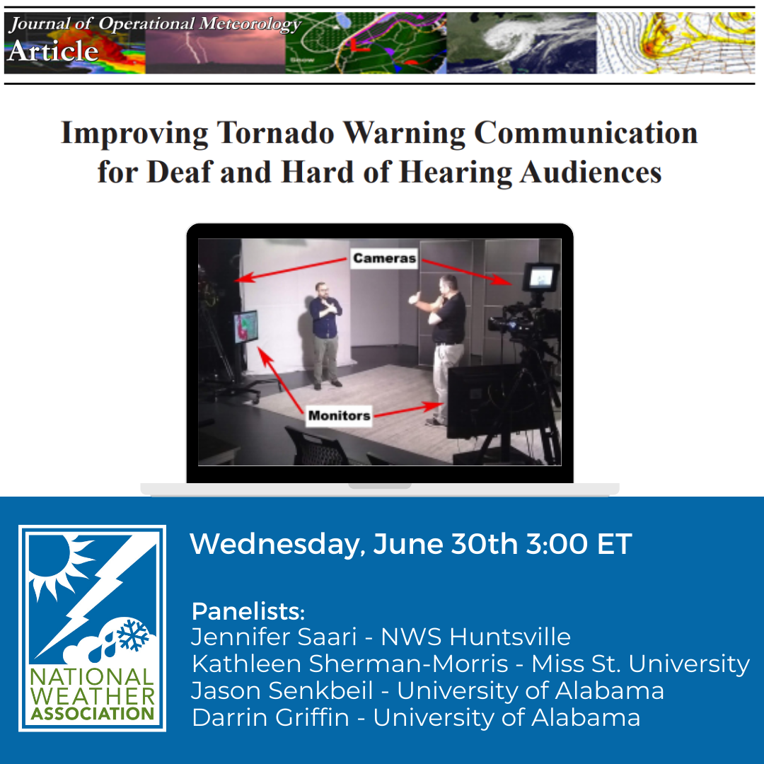
NWA June Webinar - Improving Tornado Warning Communication for Deaf and Hard of Hearing Audiences This webinar occurred on June 30 and was recorded. Links to the recording are below. The panelists are the authors of the JOM article with the same title. They are Dr. Kathleen Sherman-Morris from Mississippi State University, Darrin Griffin and Jason Senkbeil from the University of Alabama, and Jennifer Saari from NWS WFO Huntsville, Alabama. Watch the recording by registering for the webinar here or through the NWA YouTube Channel. Follow the discussion on Twitter using the hashtag #NWAWebinar. Abstract: Although specialized personal and residential Deaf warning technologies exist, receipt and comprehension of tornado warning information from local television is often delayed or misunderstood because of closedcaptioning deficiencies. In order to suggest improvements for the communication of tornado warnings to Deaf and Hard of Hearing (D/HoH) audiences, interviews and a focus group were conducted within the active tornado counties of Alabama. D/HoH individuals generally use more information sources than the hearing population to better understand their risk. Protective action decision-making by our sample was characterized by more hesitation, uncertainty, and indecision than in the hearing population. The most common suggestion for improving tornado-warning communication was to have an American Sign Language (ASL) interpreter shownon screen with a local television meteorologist during a tornado warning. A split-screen television product with an ASL interpreter in a remote studio was prototyped showing that this type of live broadcast is possible for local tornado-warning coverage. Several screen formats were evaluated by a focus group with the conclusion that the ASL interpreter should be on the left side of the screen without obscuring any part of the weather broadcast. The split-screen product with an ASL interpreter resulted in full access to all broadcast information, the ability to make immediate safety decisions, and was welcomed with excitement by the focus-group participants. This modification, along with the education and preparedness efforts of the National Weather Service, help remedy the information gaps and comprehension delays of this underserved population. "The Impact of the Storm Prediction Center’s Convective Outlooks and Watches on Emergency Management Operational Planning" is a Journal of Operational Meteorology (JOM) Short Contribution authored by Heather A. Cross, Dennis Cavanaugh, Christopher C. Buonanno and Amy Hyman. Abstract: For many emergency managers (EMs) and National Weather Service (NWS) forecasters, Convective Outlooks issued by the Storm Prediction Center (SPC) influence the preparation for near-term severe weather events. However, research into how and when EMs utilize that information, and how it influences their emergency operations plan, is limited. Therefore, to better understand how SPC Convective Outlooks are used for severe weather planning, a survey was conducted of NWS core partners in the emergency management sector. The results show EMs prefer to wait until an Enhanced Risk for severe thunderstorms is issued to prepare for severe weather. In addition, the Day 2 Convective Outlook serves as the threshold for higher, value-based decision making. The survey was also used to analyze how the issuance of different risk levels in SPC Convective Outlooks impact emergency management preparedness compared to preparationsconducted when a Convective Watch is issued. Read the Short Contribution. The JOM Article titled "Assessing the Potential for Pyroconvection and Wildfire Blow Ups" was recently published and the authors are Ryan N. Leach and Chris V. Gibson. 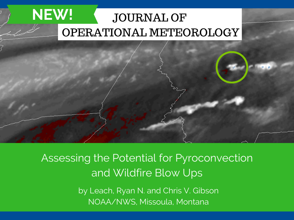
Abstract: Fire meteorologists have few tools for assessing atmospheric stability in the context of wildfires. Most tools at our disposal were developed for assessing thunderstorms and general convection, and so they ignore heat and moisture supplied by the wildfire. We propose a simple parcel-based model that can be used to assess how the atmosphere will affect a growing wildfire plume by also taking into account the heat and moisture released from the fire. From this model, we can infer trends in day to day atmospheric stability as it relates to fire plumes. We can also infer how significant the appearance of a pyrocumulus cloud on the top of a fire column is. In some cases, the appearance of a pyrocumulus indicates that the fire is near if not already blowing up, whereas in other cases environmental conditions remain too stable to have a significant effect. A qualitative application of the model is demonstrated through application to a 2017 wildfire case in Western Montana. Read the full Article.
NWA 46th Annual Meeting Update - August 21-25 This year’s meeting will be hybrid, meaning you have the option to attend and present in person (in Tulsa, Oklahoma) or virtually. The in-person portion will be held at the Hyatt Regency Downtown Tulsa. The registration desk and exhibitor setup will begin on Saturday August 20. The hotel block is open and information about attendee registration is posted. The registration form will open very soon. As you might imagine, this year has offered some unique considerations in meeting planning. It is taking us a bit longer to finalize our details and plans. Some exhibitor registrations and sponsorships are being finalized as are plans for events that have been proposed for the meeting. A preliminary agenda will be released in the next two weeks. Please watch for announcements on keynote and invited speakers that will be coming soon. There will be an Annual Awards ceremony that people can attend both in-person and virtually. Factor 110 will be providing audio, video and virtual meeting support again this year. We will use the Whova app that we used last year. Whova has added some exciting options, and the app can be utilized by both virtual and in-person attendees. We know many of you aren't sure if you will be able to attend in person while others have already decided. This will be a year where flexibility and grace will be needed as all of us navigate through all these questions. We are very excited about the content that will be presented during the meeting, and we look forward to seeing each of you whether it is in Tulsa or on Whova. Members and abstract submitters will receive updates via email, and information will be posted on our website and social media sites as it becomes available. Please stay tuned for more information as we go through the summer. Janice Bunting, CEO What’s the Big “D”...eal with the Deaf? by Trevor Boucher, NWA Board Director and Social Media Committee As the Weather Ready Nation Initiative continues to recruit people from all corners of our country, we find ourselves learning more about the communities we serve, especially those that have typically gone underserved. It’s fantastic that the weather enterprise is beginning to acknowledge and identify where our blind spots have been historically, but this comes with some consequences. One of those consequences: Ignorance. We can all cite several instances both historically and anecdotally where ignorance, even with noble intentions, can result in misunderstanding and ostracization. And while we can quickly point to ignorance existing in society when it comes to race, sexual orientation, economic standing, and others, it exists in the disability space as much as any other. If you’re talking about the condition of deafness, then perhaps disability makes sense as a medical and legal definition. But being Deaf is a culture with traditions and history that originate from overcoming obstacles and prejudice. Being a person who was born, raised, and have lived their whole life independent of their hearing, that’s a very special and unique identity. And it’s a proper noun: Deaf with a capital D.
As Weather-Ready Nation (WRN) AmbassadorsTM, we are committed to spread weather safety messages. There are many key points to share with others about the dangers of heat, lightning, rip currents, tropical storms and hurricanes, flooding, and more. Check out the WRN Summer Safety Campaign page for graphics, social media posts and other resources. The NWS and other partners appreciate this assistance.
"I want to thank all of you who participated in last week's National Lightning Safety Awareness Week campaign. I received alerts to numerous media stories and also saw many social media posts. With much of the summer ahead of us, I hope you will all continue to push lightning safety information." NWA Research to Operations Nexus Updates by Alyssa Bates and Randy Graham, NWA Weather and Forecasting Committee Wondering how the 2020 virtual Research to Operations Nexus (RON) Meetup went and whether another one is coming? Wonder no more! An NWA event since its inception in 2015, the RON Meetup provides the opportunity for an interactive discussion between research and operational meteorologists, modelers, hydrologists, and social scientists. During the event, groups rotate through a number of stations in speed-mentoring fashion to discuss a variety of opportunities for sharing ongoing research and operational needs that could benefit forecast and warning operations. The stations include a wide range of topics such as winter weather, supercells and tornadoes, communicating risk, probabilistic forecast generation, impact-based decision support services, etc. The goal is simple: to build and develop new relationships based on shared interests that span beyond traditional barriers between research and operations.
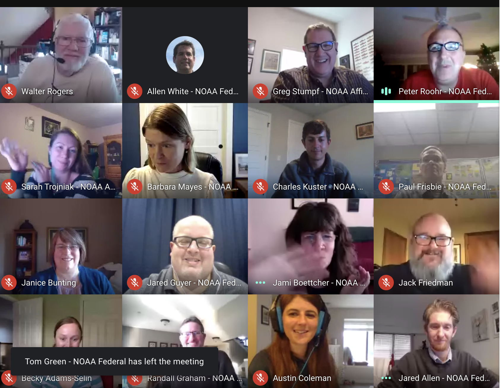
The first-ever virtual NWA RON Meetup held in December 2020, was a smashing success! Even with having to use Google Meet before it supported breakout rooms, 70 participants successfully rotated through three rounds of interaction that included lively discussions involving research and operational interests on various meteorological topics. Operational personnel and researchers made connections and gathered feedback on NOAA and other government organizations' research-to-operations processes. An unexpected benefit of the RON Meetup being virtual was that people who had never been able to attend in person could participate. There was even one participant from as far away as Guam! Many thanks to the RON planning committee, topic facilitators, NWA staff, Factor110, and of course the participants for their efforts to make this event a reality. The event was so successful that a virtual element of the RON may continue even after in-person gatherings are common again. What's next? Another RON Meetup is in store this fall! It will be a completely virtual event again this year. Stay tuned for updates to find out how you can get the opportunity to make an impact in the research-to-operations nexus this summer!
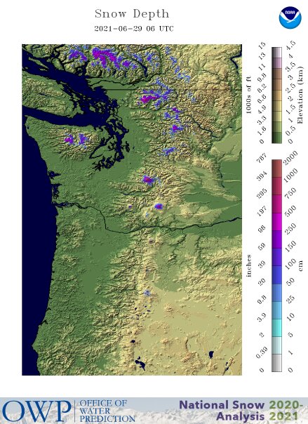
Here are a few news stories about the temperature records shattered across the Northwest U.S. and western Canada in late June.
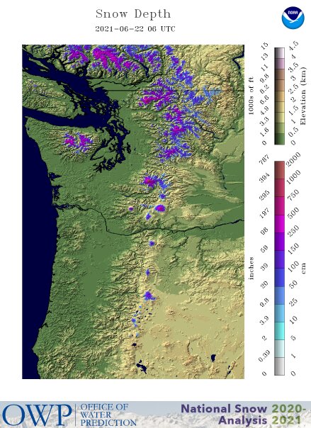
These two maps show the snow depth across the Pacific Northwest on June 22 and 29.
NWA Members have access to job announcements in the NWA Jobs Corner. If you are an employer, reach a variety of candidates by posting your open positions. Job Posting Information
Current Jobs: Applied NWP/Geophyscial Modeler - Baron Services Land Forecast Meteorologist - Compuweather Forecasting Division Meteorologist I - The University of South Alabama Editorial Manager - Weather & Radar
The 22nd Northeast Regional Operational Workshop Call for Papers
The next #DistantSocial will be held on Thursday July 8 starting at 8:30 pm ET. All NWA members are invited to join the conversation!
Mark your calendars for the August Distant Social on August 11.
NWS Seeking Comments through July 31, 2021, on Providing NWP Data in the Cloud
Comments comments will be accepted through July 31, 2021. See the full announcement for much more information.
The full NWA Event Calendar is located in Member Connect. Have an event to include on our NWA calendar? Submit them to [email protected]! The NWA Newsletter welcomes relevant articles on association news, recent and historic weather events, professional development, member news and much more. All members are encouraged to submit articles for consideration. Please see the Instructions for Authors.
National Weather Association | 3100 Monitor Ave, Suite 123 | Norman OK 73072 | 405.701.5167 Publisher: Janice Bunting, NWA CEO Submit newsletter items to [email protected] |

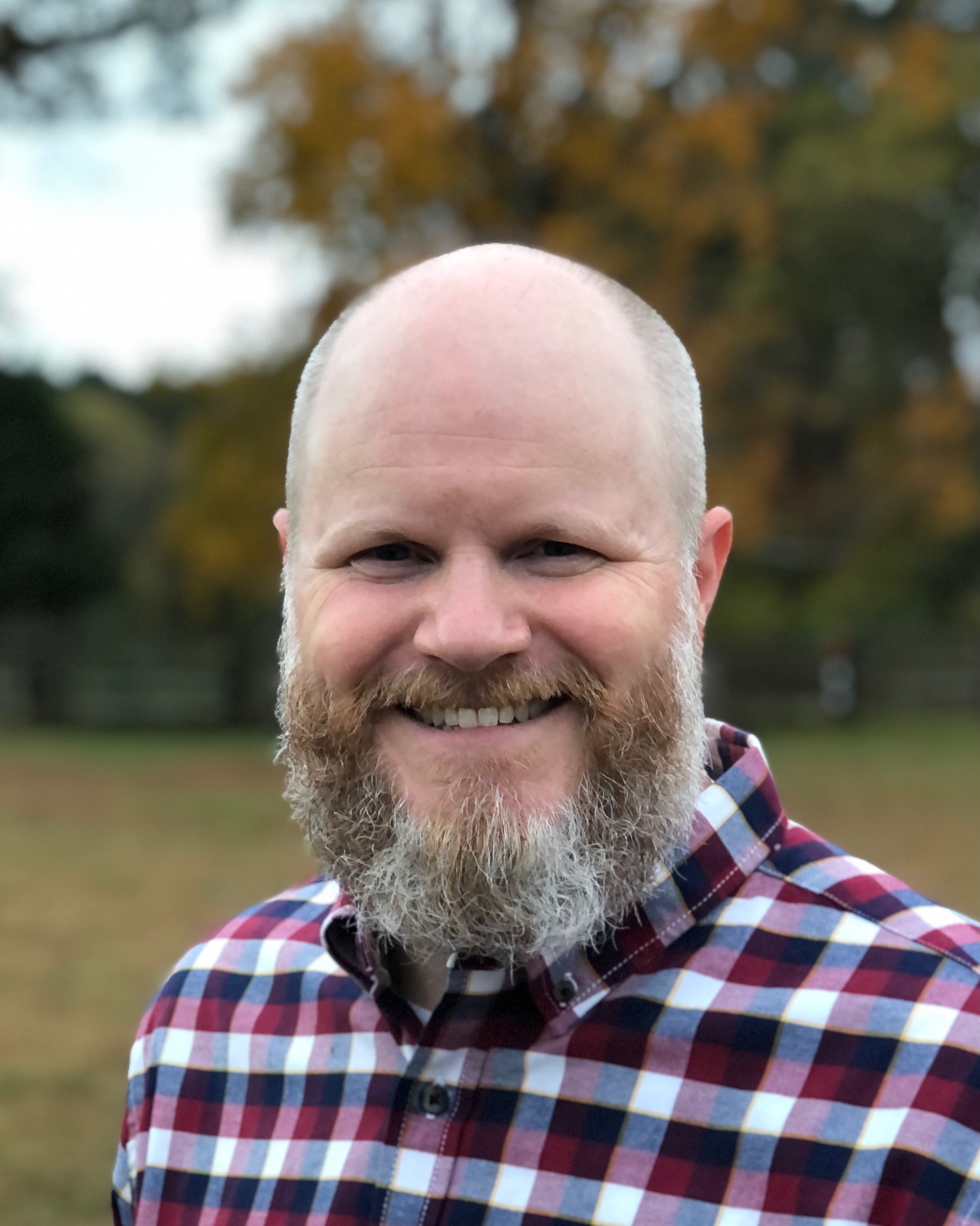
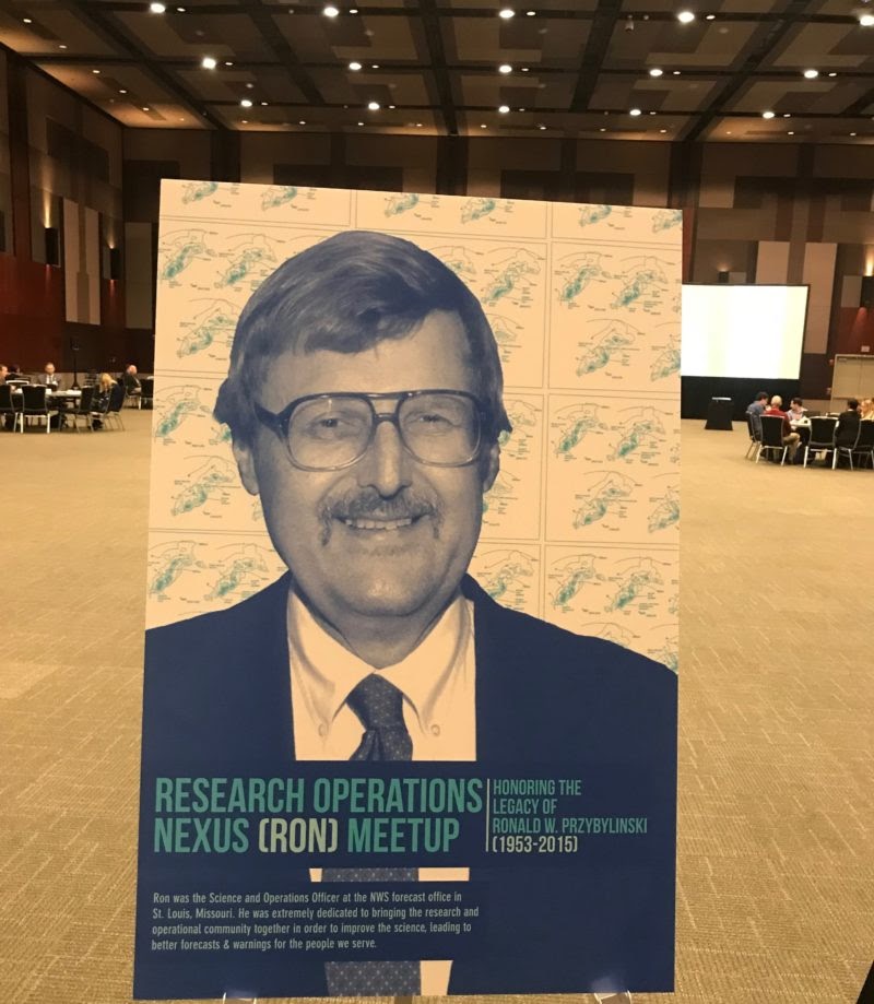 The idea in RON meetups was inspired by the memory of Ron Przybylinski (picture to the left). Ron was a former Science and Operations Officer (SOO) of the National Weather Service Forecast Office in St. Louis, Missouri, and he left the legacy of his unending motivation to interconnect weather operations and research in strong, meaningful, and enduring ways. Ron was a master in the transition zone, or nexus, of operations and research. Research interactions with Ron led to large field projects that provided great benefit to both the operational and research communities.

 The 22nd Northeast Regional Operational Workshop will be held virtually via GotoMeeting on November 9-10, 2021. The