NWA February 2021 Newsletter
Issue 21 - 02
What's in this newsletter:

President's Message
NWA President Nate Johnson

NWA 2021 President Nate Johnson

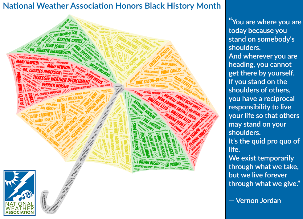
During its annual meeting last month, the American Meteorological Society announced it is renaming its award for broadcast meteorology after pioneering meteorologist June Bacon-Bercey. While other African-American women had presented weather forecasts on the air, she was the first female, African-American, degreed meteorologist to do so.  Her story includes many other firsts, including being one of the first — if not the first — African-American woman to earn a degree in meteorology in 1954 and becoming the first African-American woman to earn the AMS’ Seal of Approval for TV Weathercasting in 1972. She worked in broadcasting, in the public sector, and as a collegiate instructor, winning numerous awards for merit along the way. She even won $64,000 on a game show, allowing her to endow a scholarship for students studying meteorology.  

Naming the broadcast award after her is a fitting tribute to someone with such an amazing and diverse career — Someone I admit I had not heard of before a couple of years ago.

Someone else whose story I did not know until recently is Jim Tilmon. After graduating college and serving in the military, he went on to a decades-long career flying for American Airlines. He was only their third African-American pilot and was frequently mistaken for a skycap or flight attendant.  Following that, he transitioned to a decades-long second career as a broadcaster in Chicago, first hosting a weekly program focusing on Black people and issues — the first such program, according to the station — then as an on-air forecaster, weather presenter, and aviation analyst beginning in the early 1970s. Tilmon passed away last month, and it was only then that I learned about him and his career.

I like to consider myself reasonably well-plugged-in to our industry. I am active in the NWA and AMS. I am able to attend conferences. I read books, blog posts, and articles. I am on a weekly weather podcast. I even teach a broadcast meteorology course — a course that spends much of its first week exploring the people and historical forces that have shaped the broadcast weather industry. Yet I did not know of these two noteworthy, trailblazing people in our industry. And there are certainly others.

This is one reason I am thankful for Black History Month and similar periods throughout the year. On one level, they are an opportunity to focus on people whom we really should be getting to know and stories that we should be telling all year long. And they help to address the natural blind spots that exist when we view our collective history through the lens of our experiences. The goal is to educate ourselves and broaden our perspective all year long so our understanding of the weather community’s story grows richer and ever more complete.

To that end, the NWA is using this month to share not only stories of our past but also of our future. I am really excited that, as part of our celebration, we are highlighting recent winners of the NWA Foundation’s David Sankey scholarship. These talented people are writing not only their compelling stories but their own lines in our collective story as the NWA and the weather and climate enterprise. I believe you will enjoy getting to know them this month.

Sources:

https://www.nytimes.com/2020/01/07/science/june-bacon-bercey-90-pathbreaking-meteorologist-is-dead.html

https://www.accuweather.com/en/weather-news/the-untold-story-of-june-bacon-bercey-the-1st-american-woman-to-become-a-tv-meteorologist/335929

https://physicstoday.scitation.org/do/10.1063/PT.6.6.20181023a/full/

https://www.encyclopedia.com/education/news-wires-white-papers-and-books/bacon-bercey-june-1932#E

https://chicago.suntimes.com/2021/1/16/22178950/jim-tilmon-chicago-newsman-weather-meteorologist-pilot-wmaq-wttw-tv-american-airlines-obituary

https://www.nbcchicago.com/news/local/jim-tilmon-longtime-nbc-5-forecaster-dies-at-86/2417684/

Return to Top


National Weather Association Honors Black History Month
by NWA Diversity Committee

In honor of National Black History Month, the NWA Diversity Committee would like to invite you to celebrate, learn, and participate in events throughout this month to honor those African Americans who have been trailblazers in the field of meteorology; those who continue their contributions to the advancement of our field; and to the developing, ambitious, up and coming new generation of operational meteorologists.

The umbrella consists of 35 highlighted names of notable African Americans in the meteorology field past and present. While it absolutely is not a complete list, it does contain many with “firsts” in the field. The colors chosen are representative of traditional African colors rich in symbolism and heritage.

The shape of the umbrella was utilized not only for a weather theme to the graphic, but for a few other reasons. Umbrellas can be viewed as a sign of progress and protection; they also are a sign of privilege in thinking of U.S. Southern culture.

On the flip side of privilege, the use of an umbrella has been seen as protection in protests. This occurred most recently in protests against police brutality in Seattle in 2020. This stood out significantly because Seattleites do not use umbrellas given their weather and climate.

Typically, you can easily point out the transplants or tourists by their use of an umbrella when it is rainy. The umbrella is prominent in Creole culture in Second Line parade traditions celebrating life especially in the city of New Orleans. On this note, the design acknowledges the current state we are in with the continuing COVID pandemic and traditional gatherings being canceled such as Mardi Gras and Carnival.

Return to Top


Submit Your Nominations for the 2021 Annual Awards

More information on the NWA Annual Awards Program.

Submit a nomination.

Return to Top


The Carpenters’ Blizzard: 'Weather Technology ‘Now and Then’
Michael Smith, CCM, President, Mike Smith Enterprises, LLC
NWA Charter Member

What do The Carpenters—the blockbuster singing duo of the 1970’s—have to do with a record-shattering blizzard in the Great Plains that occurred 50 years ago this month? And how has our ability to nowcast and warn of violent tornadoes and blizzards changed in the intervening five decades?

The February 20-22, 1971, Carpenters Blizzard1 established records that still stand, including the State of Oklahoma’s single storm record (36 inches at Buffalo) and Wichita’s single storm record (12 inches). Wind gusts of 50 to 70 mph across the southern High Plains caused peak drifts of more than 25 feet. The drifts necessitated two weeks of desperate National Guard airlifts of hay to tens of thousands of cattle cut off from ranchers in Texas, Oklahoma and Kansas. In 2017, KOCO-TV in Oklahoma City called it “the most intense winter storm to ever hit the Sooner State.”

In addition to the fierce blizzard, tornadoes in Louisiana and Mississippi killed 123. Those tornadoes included Louisiana’s only F-5 (ever). An F-4 tornado threw five victims from their home into a bayou. Their bodies were not found for weeks. At one time the Jackson, Mississippi, RAREP (hourly coded teletype summary of what was depicted by the radar) carried four “hook” designations simultaneously. The national radar chart from 11:35 a.m. CST (1735 UTC) on February 21 (Figure 1) represents conditions at the start of the outbreak. The outline of tornado watch #37, in effect from 10 a.m. to 4 p.m., is depicted by dashed lines and highlighted with an arrow. Minutes after the time of this chart, the first tornado reports came in from far northeastern Louisiana. The first significant (F-2 or greater on the original Fujita Scale) touched down in northeast Louisiana at 3:10 p.m. and promptly moved into the watch area.


Figure 1. National radar chart from 1735 UTC (11:35a.m. CST) on February 21, 1971. Tornado watch number 37 is highlighted. 

1971 Technology
The WSR-57 network was so sparse that a non-existent break in the snow pattern was depicted on the radar chart. The WSR-57 spacing (Wichita and Garden City, Kansas, Amarillo, Texas, and Oklahoma City) was so course their beams overshot the relatively low stratiform precipitation tops. In addition, it was snowing over eastern New Mexico, Colorado east of the Front Range, and southern Nebraska. None of that snow made it onto the radar chart. An inexperienced user, such as a weekend pilot (common in that era), would have greatly underestimated the geographic extent of the snow.

At that time, radar was analog in black and white, and there was no practical way to get a quality signal or picture from one location to another. Radar image remoting2 would not be invented for another six years. The only graphic representation was plots of teletype RAREPs that came via the national meteorological facsimile network (NAFAX). That data was nearly an hour old by the time it arrived. The bandwidth of NAFAX (this was before DIFAX) was so low that only about two-thirds of the hourly charts could be transmitted each day.


Figure 2. Jackson, Mississippi, WSR-57 radar image from 4:20 p.m. CST on February 21, 1971. Three tornadoes were in progress northwest of Jackson at this time.

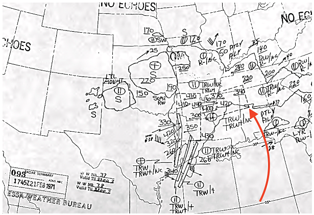
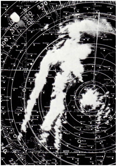
The available data was only marginally better at the Jackson, Mississippi, NWS office. Figure 2 depicts the black and white radar image at 4:20 p.m. when there were three tornadoes in progress (can you find their radar signatures?). The image in Figure 2 is an improvement over the radar displays in that era. It was created using a camera positioned above a plan-position indicator (PPI) radar scope with a hood that kept light out, allowing the camera shutter to be open for the entire 360-degree sweep. This produced a photograph of all the echoes on the screen. The meteorologist using this PPI had to deal with the storms fading on the display almost immediately after the radar “swept” them. For that reason, radars were operated in dark rooms, which made tracking spotter reports, typing warnings, and communicating information even more challenging. Doppler and dual-polarization (D-P) displays were not available.

The effective warning of the Birmingham, Alabama, tornado of January 25 this year was only made possible by Doppler and D-P technology. A similar nighttime tornado in 1971 would almost certainly have been unwarned until a spotter report came in, which would probably have been too late.

Forecasting the Storm
In 1971, I was a freshman in the University of Oklahoma (OU) School of Meteorology. Like all meteorology schools of that era, OU’s Felgar Hall had a 24/7 “map room” with loud teletypes and a loud wet paper meteorological NAFAX machine. Students could hand-plot surface charts, upper air charts, or whatever data they wished. In 1971, OU’s meteorology department did not have access to radar.

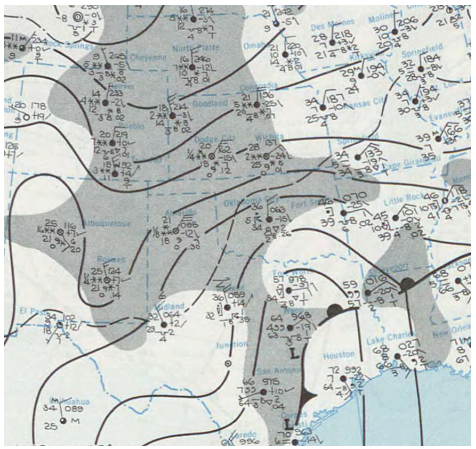
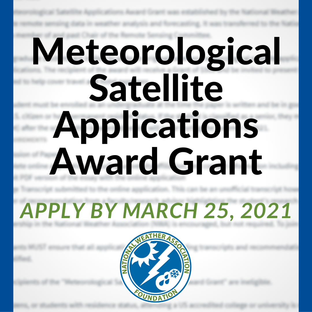
Figure 3. “Daily Weather Map,” 6 a.m. CST, February 21, 1971.

I arrived in the map room around 11 a.m. on February 21 It was as crowded with students as I had ever seen it including legendary future meteorologists like Al Moller and John McGinley. The excitement level was high as were the volumes of voices due to both excitement and frustration because we were certain this was a major, or even unprecedented, event. The frustration was because it was impossible for us—or any organization that needed to track the weather in real-time on a national or regional basis (e.g., airlines like TWA, Braniff or Southern3 that served the affected areas)—to fully understand the extent and intensity of the storm. We students were shouting, “four flake snow at Gage (Oklahoma),” which was a reference to the diamond-shape arrangement of asterisks plotted from a report of heavy snow, or “hook reported from Jackson.”

The synoptic-scale cyclone developed in Texas ahead of a negatively tilted trough at 500 millibars (mb). The blizzard was well to the northwest of the path of the surface low; farther than one might have expected. At 12 UTC Sunday, February 21, there was a 996 mb surface low near Waco (Figure 3). It moved north-northeast and intensified to 990 mb 24 hours later in central Missouri at 12 UTC Monday. The orientation of the precipitation around the low shifted as the warm and cold fronts occluded. The change in orientation of the snow field prolonged the duration of the snowfall. The cold front drawn on the Sunday map was actually the dry line (which was not understood in 1971). The cold front was about 100 miles to the west. By 12 UTC Monday, thundersnow was reported from eastern Nebraska to western Iowa. It is likely that convective snow occurred farther southwest the previous day but that could not be ascertained by the available data.

Roads were closed for days throughout the region. In Wichita, mail service was suspended on Monday, February 22, and even beyond in some parts of the city. It is still considered to be the city’s worst blizzard. My recollection is that the intensity of the blizzard was not adequately forecast. That seems to be confirmed by the fact the Sunday Wichita Eagle on the 21st did not include a news story forecasting a major snowstorm.

The storm was the lead story Monday’s Eagle (February 22). The Monday headline of The Great Bend Daily Tribune was “Storm of the Century Immobilizes Kansas.” The Hutchinson News lead story Monday was “Wild Blizzard Buries Entire State.” At the bottom of its front page was a smaller headline “Twisters Kill 21 in the South.” Tragically, that was a serious understatement.

The tornadoes occurred near a warm front (Figure 3). The National Severe Storms Forecast Center’s watches did a fine job of alerting the public ahead of the event with the first watch issued at 10 a.m. (Figure 1). According to the after-event Service Assessment (SA), the local NWS offices did an outstanding job with the warnings. Still, 123 people died because, the assessment found, the warnings were often not received by those that needed them and that many homes in the Mississippi Delta did not have basements. I would add that the late Sunday morning timing—with people sleeping in or occupied by going to church—would also be a reason why the information was not received on a timely basis. Some of the SA’s recommendations involve challenges we face today:
⦁ Aids and techniques should be developed to automate the composition and dissemination of watch and warning bulletins to the greatest possible extent.
⦁ The field investigation of all major tornadoes should include an early aerial reconnaissance survey to determine storm paths more accurately.
⦁ Public safety authorities should be encouraged to develop distinctive warning signals to warn of approaching tornadoes and particularly the immediate need to take cover.

The Carpenters
While the blizzard was in progress, The Carpenters were struggling to get to a concert at Northwestern Oklahoma State University in Woodward scheduled for Monday night the 22nd.

The group’s blockbuster hits “Close to You” and “We’ve Only Just Begun” were released the year before and “For All We Know” was No. 12—on its way to No. 1 on the Billboard Hot 100—the week of the blizzard.

Woodward had 17 inches of snow with major drifting on the 21st. While the motto of show business is “the show must go on,” their struggle was such that I have been able to confirm that Richard Carpenter still has a distinct memory of the event fifty years later.

Richard Carpenter began their concert in Tulsa on the 23rd by telling the audience, “We nearly didn’t make it tonight because we were struggling to get out of town due to a blizzard at Northwestern State University.” I spoke with Karen Carpenter (I was covering the Tulsa concert for KGOU-FM in Norman) that night after the concert. She told me the trailers they were towing were swaying in the wind and it was hard to stay on the road.

Technology Today

Fifty years later,
⦁ There would almost certainly be a blizzard warning for the storm. A winter storm watch would have been issued two days before. It is likely the Carpenters would have known what they were driving into.
⦁ The tornado watch would likely have stated this was a “Particularly Dangerous Situation.
⦁ The morning convective outlook which forecast a “few” severe thunderstorms (equivalent to today’s “slight risk”) would likely have forecasted a “moderate” or “high" risk.
⦁ The tornado warnings, since they resulted from supercellular storms, would be smaller in size and equally timely. The smaller size is desirable to limit geography-related false alarms.
⦁ In addition to the tornado sirens and radio warnings in 1971, television stations would be in wall-to-wall coverage, NOAA All-Hazards Radio would trigger, and apps from commercial companies would trigger based on the user’s proximity to danger as determined by GPS using storm-based polygons.
⦁ A half-century after this storm meteorology still struggles at times to effectively communicate forecasts of extreme weather and to engender public response.

These products and procedures are just a small sample that show how weather science has advanced in the last 50 years.

FOOTNOTES
1 So named for the reason discussed herein.
2 “Radar image remoting” was a term coined by the late Steve Kavorous who invented a device to send a color radar image from one of his devices to another. It was a giant step forward in meteorology.
3 In 1977, Southern Airways would suffer a major thunderstorm-related crash (63 fatalities) in a radar gap in northwest Georgia.

Return to Top


Fultondale EF-3 Tornado of January 25, 2021
via Weather.gov

Central Alabama was involved within a warm sector ahead of an approaching cold front during the night of January 25th, 2021, featuring dew points in the low to mid 60s and surface-based instability reaching as high as 1,200 J/kg. Strong wind shear was in place which, combined with instability, favored a risk for severe storms. Upper-level troughing was displaced well toward the northwest, which helped to limit the number of severe storms, with just one or two occurring throughout the event.

Read more at weather.gov.

Return to Top


Apply to the Meteorological Satellite Applications Award Grant by March 25, 2021


Apply for the grant, and view more information at nwafoundation.org.

Return to Top


Call for Abstracts Now Open!

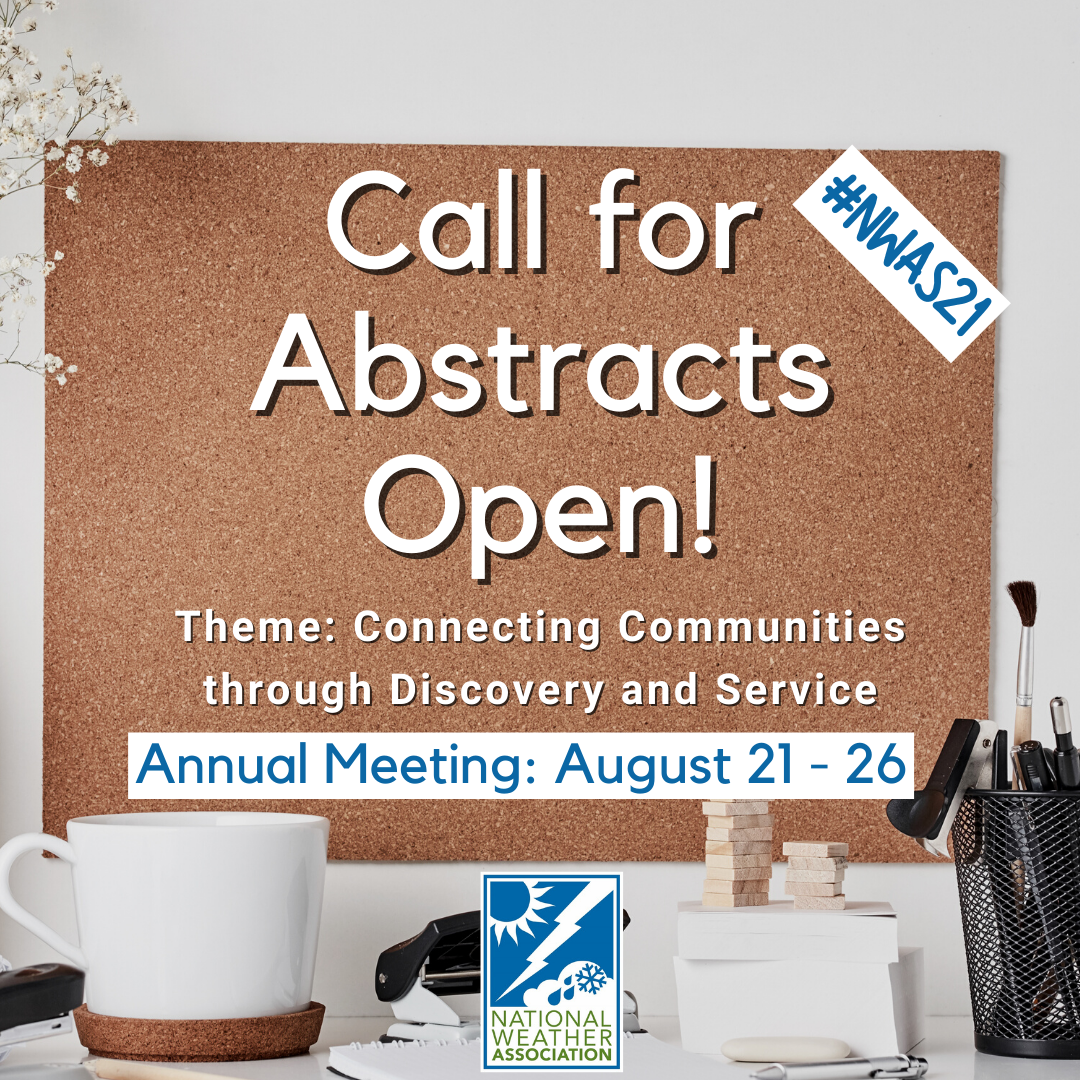
The Call for Abstracts is open!

Please review the information on guidelines, categories, important dates and this year's theme before submitting.
View our Call for Abstracts page for more information and to submit.

Students and Active Military members can submit abstracts at no cost, and the fee for all other members is $40.

The NWA Annual Meeting will be a hybrid event held on August 21 - 26, virtually, and in Tulsa, Oklahoma. We hope to see you there! #NWAS21

NWA Event Calendar

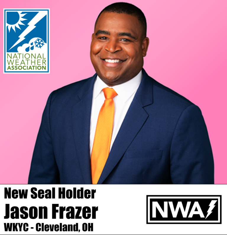
The full NWA Event Calendar is located in Member Connect. Have an event to include on our NWA calendar? Submit them to [email protected]!

Return to Top


Seal Holders: Jennifer Perez and Jason Frazer

Get to know our recent Seal Holders!

Jennifer Perez is the weekday morning meteorologist at WLUC TV 6 in Michigan’s Upper Peninsula. While Jennifer has always been intrigued by weather, it was not until she was a senior in high school that she considered it as a possible career. At that point, she was encouraged to take a station tour at her local news station and after that, it all started coming together for her.

She earned her degree in 2011 from the University of Central Florida and then landed her first television job as a reporter and fill-in anchor at WLUC-TV 6 in Marquette, Michigan in 2012. While there, she began working on her meteorology degree through Mississippi State University.

In 2015 she accepted her first weather position at WILX in Lansing, Michigan. In May 2016, she graduated from Mississippi State with her degree in broadcast meteorology. From there, her career took her to KSPR in Springfield, Missouri, before she made the return trip to WLUC in 2018.

Jennifer loves being able to play a role in “helping people shape their day.” She also knows she plays a role in helping keep viewers safe and informed when severe weather rolls in.

***

Jason Frazer is currently the weekend morning meteorologist at WKYC in Cleveland, a position he began in September 2019. However, meteorology is actually his third career.
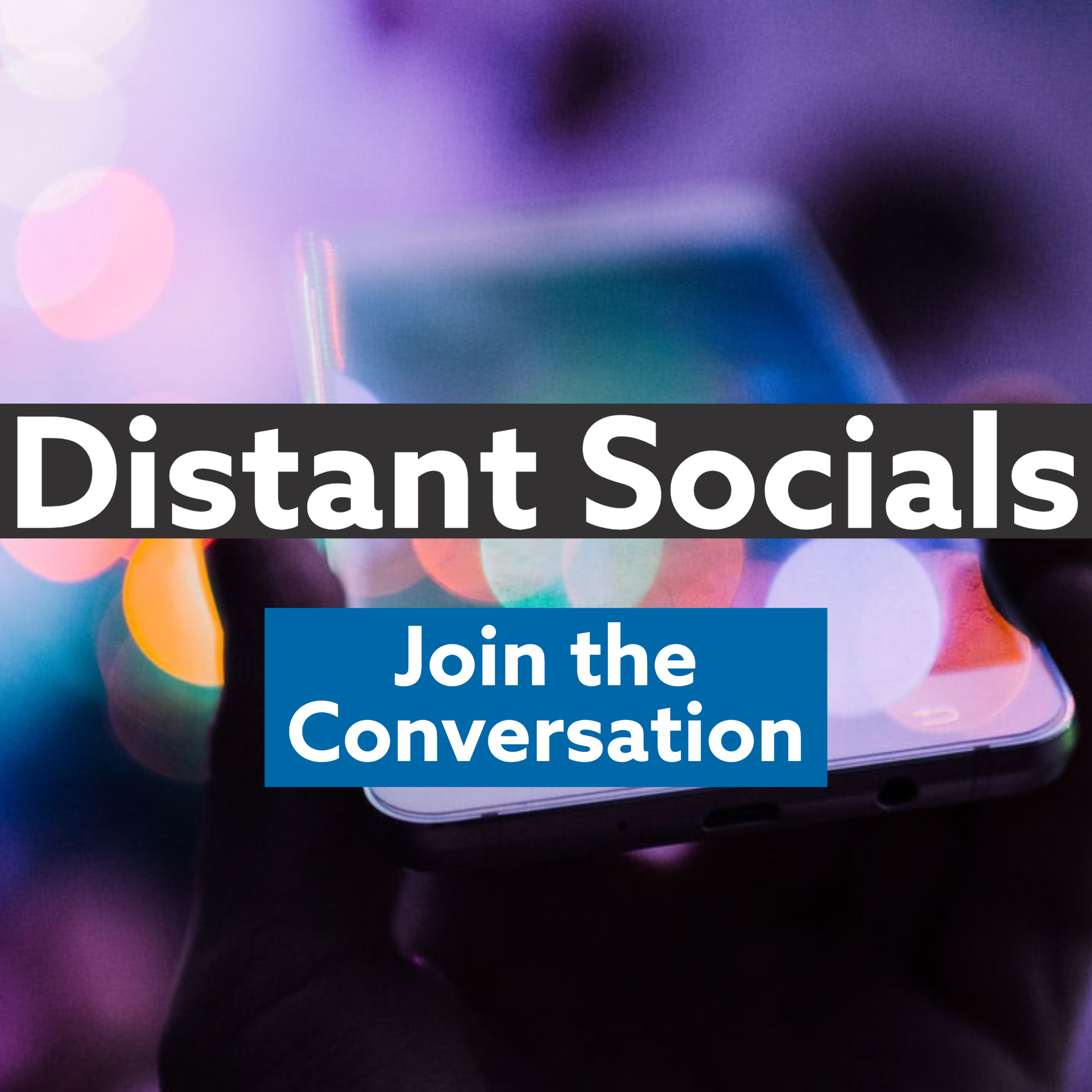
Jason’s first degree came from Columbia University in political science. Following graduation, he worked as a bank branch manager for several years before deciding to become a reporter. As a reporter, he spent several years working in four cities: Columbus, Ohio, Hartford, Connecticut, Rochester, New York, and Boston, Massachusetts. At that point he decided to trade in reporting for weather. He states, “I was always interested in weather and figured if I didn’t make the switch then, when would be the appropriate time to do it?”

His first weather job was at the Fox station in Savannah, Georgia. Right after his arrival, Hurricane Irma impacted the area. Jason quickly completed the Mississippi State Broadcast Meteorology Program in just two years.

One of the things Jason likes most about his job is “the interaction with students and inspiring the next generation of meteorologists." Of course, COVID-19 has caused all his school visits to be virtual, which has allowed him to do more school talks than when they were in person.
His favorite part of meteorology is that each storm is different. There is always something new to learn about the weather.

Return to Top


NWA Distant Socials Schedule 
Distant Socials: Join the Conversation
Schedule:
Thursday, February 25th
Tuesday, March 9th

Each Distant Social begins at 8:30 p.m. ET. More information about joining here.

NWA Jobs Corner

Are you hiring? Reach a variety of candidates through the NWA Jobs Corner.

NWA Jobs Corner

Current Jobs:

Submit a job here!

Department Chair - Applied Sciences College of Arts & Sciences, Embry-Riddle Aeronautical University-Worldwide (2/8/2021)

Return to Top


 National Weather Association | 3100 Monitor Ave, Suite 123 | Norman OK 73072 | 405.701.5167 

Publisher: Janice Bunting, NWA CEO
Editor: Bryce McElhaney, NWA Communications and Marketing Coordinator
Technical Editor: Winnie Crawford

Submit newsletter items to [email protected]
using the NWA Newsletter Instructions for Authors

Copyright © 2021 National Weather Association, All rights reserved.